Kant Island
The former Kneiphof, now a park island in the Pregolya holding the restored cathedral and the tomb of Immanuel Kant, sits at the exact centre of the city plan.
Minimalist map poster · Russia
54.7064° N / 20.5110° E
The Pregolya splits around a small island in the centre, with old ponds, ring forts and a wide lagoon to the west.

One city, five moods
Tap a style to see it on the wall. Every style costs the same — printed, framed or as HD files.
 Actual pixels · 24 × 36″ print file
Print-sharp
This is a 100% crop of the real print file. Every poster — printed, framed or downloaded — is rendered on our servers at 300 DPI, up to 7,200 × 10,800 pixels, so even the smallest lanes stay crisp on a 24 × 36″ print.
On the wall

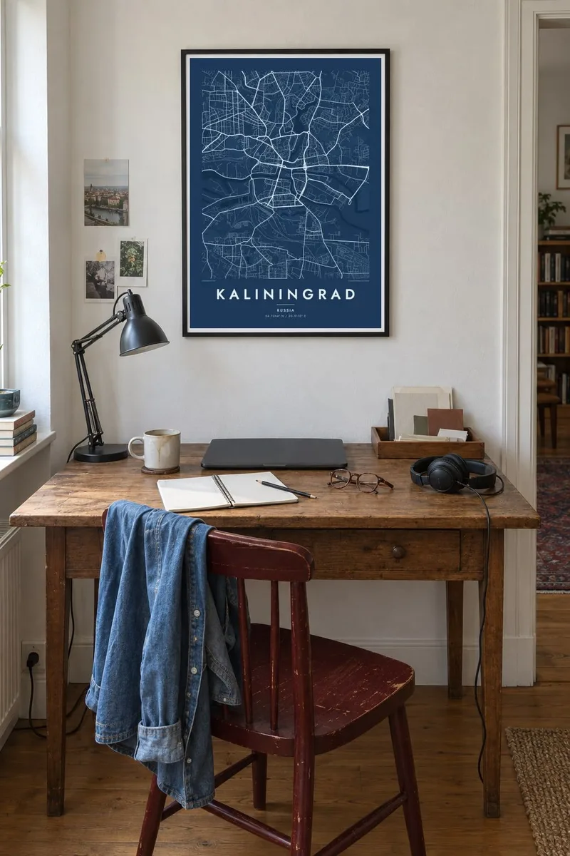

The map
Kaliningrad sits on the Pregolya River a short distance before it enters the Vistula Lagoon, and the river gives the map its spine. In the centre the channel divides into two arms around Kant Island, once the heart of medieval Königsberg, before rejoining downstream on its way past docks and industrial quays toward the lagoon and the Baltic.
North of the river two long ponds, the Upper and the Lower, run into the city like fingers, framed by parks and villas that survived the war. Around the older city runs a broken ring of nineteenth-century brick forts and gates, still visible as a loose circle of green spaces and curving boulevards on the modern street plan.
The city was German Königsberg until 1945 and is now the centre of a Russian exclave between Poland and Lithuania. Its bridges inspired Leonhard Euler’s 1736 puzzle, often cited as the starting point of graph theory. A Kaliningrad map poster shows the island and the river arms where that problem began, drawn in clean, precise lines.
The former Kneiphof, now a park island in the Pregolya holding the restored cathedral and the tomb of Immanuel Kant, sits at the exact centre of the city plan.
Two elongated reservoirs dating back to the era of the Teutonic Order stretch north from the centre, their curving shores lined with promenades and quiet residential streets.
West of the port the Pregolya opens into the Vistula Lagoon, where a dredged shipping canal runs along the shore toward Baltiysk and the open Baltic Sea.
Make it yours
Add a date, a name or a line of your own, switch style, size or orientation.
The free preview is low-resolution with a watermark. Prints and HD files are rendered at 300 DPI, up to 7,200 × 10,800 px, without a watermark.
Why Kaliningrad
People who hang Kaliningrad often have a connection to both of its names, whether family roots in old Königsberg or years spent in the modern city. The plan holds both layers at once, with Teutonic ponds and Prussian forts sitting beneath Soviet avenues.
The title, subtitle and coordinates line are yours to change, so the poster can read Königsberg, Kaliningrad or a date that matters. Pick one of five styles, such as Noir or Paper, then download the 300 DPI files for $9 or order a matte print shipped from a nearby partner.
Order the Kaliningrad poster| Print size | Resolution | Files |
|---|---|---|
| 30 × 40 cm11.8 × 15.7″ | 3,543 × 4,724 px | PNG · PDF |
| 29.7 × 42 cm (A3)11.7 × 16.5″ | 3,508 × 4,961 px | PNG · PDF |
| 42 × 59.4 cm (A2)16.5 × 23.4″ | 4,961 × 7,016 px | PNG · PDF |
| 45.7 × 61 cm18 × 24″ | 5,400 × 7,200 px | PNG · PDF |
| 50 × 70 cm19.7 × 27.6″ | 5,906 × 8,268 px | PNG · PDF |
| 61 × 91.4 cm24 × 36″ | 7,200 × 10,800 px | PNG · PDF |
For comparison, the free preview is 900 px wide, watermarked and meant for screens. The HD files have up to 8× the resolution in each direction and print cleanly at full poster size.
Pick a style at the top of the page, then choose Printed Poster — a size and, if you like, a frame — or Digital HD Files. Checkout takes one step, and your order page updates as soon as the payment goes through.
It is printed on premium 200 gsm matte paper in one of six sizes, from 30 × 40 cm to 24 × 36″. Printed posters start at $39, shipping included.
Yes. Choose a solid wood frame in black, white, natural oak or dark wood. It comes with shatterproof glazing and is ready to hang. Framed posters start at $99, shipping included.
Shipping is free to 60+ countries. Each poster is printed by the nearest of our print partners in 30+ countries and usually arrives in 3–7 business days. You can follow the status and tracking under My Orders. A few countries take 2–5 weeks, and where we don't ship yet, the site tells you before you pay.
Send us a photo within 14 days of delivery and we will reprint it for free or refund you.
Yes. In the editor on this page, change the title, the subtitle and the coordinates line to anything you like, and pick a style and size. Printed, framed and digital orders all use exactly your design.
For $9 you get 300 DPI PNG and print-ready PDF files in all six sizes, without a watermark, to print anywhere. Not sure yet? Download a free watermarked preview first.
Nearby
