Alster lakes
The small Binnenalster and the much larger Aussenalster sit in the middle of the city, their open water forming the calmest and most recognisable shapes on the poster.
Minimalist map poster · Germany
53.5507° N / 9.9930° E
A port city on the Elbe with two Alster lakes at its heart and canals threading between warehouses

One city, five moods
Tap a style to see it on the wall. Every style costs the same — printed, framed or as HD files.
 Actual pixels · 24 × 36″ print file
Print-sharp
This is a 100% crop of the real print file. Every poster — printed, framed or downloaded — is rendered on our servers at 300 DPI, up to 7,200 × 10,800 pixels, so even the smallest lanes stay crisp on a 24 × 36″ print.
On the wall


The map
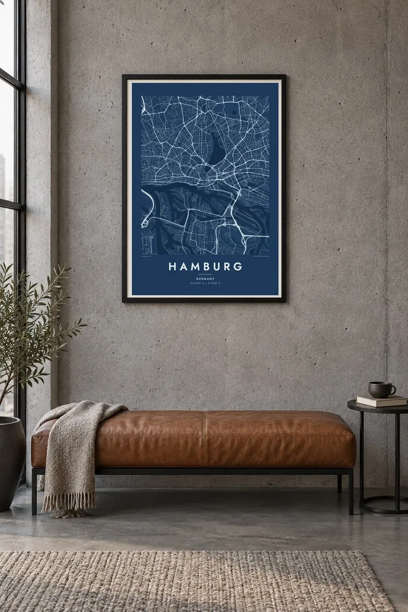
Hamburg sits on the Elbe around a hundred kilometres from the North Sea, and its map is shaped by water at every scale. The river splits into channels around the port, the Alster widens into two lakes in the city centre, and narrow canals, the Fleete, run between buildings. Few European cities show so much open water, or in black and white so much pale space, in their outline.
The port is one of the largest in Europe, filling the south bank with docks, basins and container terminals that print as long, clean-edged shapes. North of the river, the Speicherstadt, a UNESCO-listed warehouse district of red-brick blocks set on oak piles, leads into HafenCity, where the Elbphilharmonie stands on a former quay. Hamburg is often said to have more bridges than any other European city.
A Hamburg map poster brings these layers together: the inner lake of the Binnenalster, the larger Aussenalster ringed by villas and rowing clubs, the regular streets of Eimsbüttel and the curving docks across the Elbe. It is a map with strong horizontal movement and a quiet centre, easy to read from across a room and rewarding to study closely.
The small Binnenalster and the much larger Aussenalster sit in the middle of the city, their open water forming the calmest and most recognisable shapes on the poster.
The warehouse district's narrow canals and long brick blocks create a precise pattern of parallel lines, one of the finest details in any map of Hamburg.
South of the Elbe, harbour basins cut into the land like the teeth of a comb, a geometry that only a working port of this size produces.
Make it yours
Add a date, a name or a line of your own, switch style, size or orientation.
The free preview is low-resolution with a watermark. Prints and HD files are rendered at 300 DPI, up to 7,200 × 10,800 px, without a watermark.
Why Hamburg
Hamburg is a city people feel attached to for its water, its weather and its neighbourhoods. A map suits a first flat in Altona, an office in HafenCity, or a Hamburger living elsewhere who wants the Alster back on the wall.
Change the title to your district or a family name, add a date such as a wedding or a move, and adjust the coordinates line. Pick one of five styles, Classic black & white, Noir, Paper, Blueprint or Sand, in any of six print sizes.
Order the Hamburg poster| Print size | Resolution | Files |
|---|---|---|
| 30 × 40 cm11.8 × 15.7″ | 3,543 × 4,724 px | PNG · PDF |
| 29.7 × 42 cm (A3)11.7 × 16.5″ | 3,508 × 4,961 px | PNG · PDF |
| 42 × 59.4 cm (A2)16.5 × 23.4″ | 4,961 × 7,016 px | PNG · PDF |
| 45.7 × 61 cm18 × 24″ | 5,400 × 7,200 px | PNG · PDF |
| 50 × 70 cm19.7 × 27.6″ | 5,906 × 8,268 px | PNG · PDF |
| 61 × 91.4 cm24 × 36″ | 7,200 × 10,800 px | PNG · PDF |
For comparison, the free preview is 900 px wide, watermarked and meant for screens. The HD files have up to 8× the resolution in each direction and print cleanly at full poster size.
Pick a style at the top of the page, then choose Printed Poster — a size and, if you like, a frame — or Digital HD Files. Checkout takes one step, and your order page updates as soon as the payment goes through.
It is printed on premium 200 gsm matte paper in one of six sizes, from 30 × 40 cm to 24 × 36″. Printed posters start at $39, shipping included.
Yes. Choose a solid wood frame in black, white, natural oak or dark wood. It comes with shatterproof glazing and is ready to hang. Framed posters start at $99, shipping included.
Shipping is free to 60+ countries. Each poster is printed by the nearest of our print partners in 30+ countries and usually arrives in 3–7 business days. You can follow the status and tracking under My Orders. A few countries take 2–5 weeks, and where we don't ship yet, the site tells you before you pay.
Send us a photo within 14 days of delivery and we will reprint it for free or refund you.
Yes. In the editor on this page, change the title, the subtitle and the coordinates line to anything you like, and pick a style and size. Printed, framed and digital orders all use exactly your design.
For $9 you get 300 DPI PNG and print-ready PDF files in all six sizes, without a watermark, to print anywhere. Not sure yet? Download a free watermarked preview first.
Nearby
