Hussain Sagar
A sixteenth-century artificial lake near the centre of the map, with a large statue of the Buddha on an island and the Tank Bund road along its eastern side.
Minimalist map poster · India
17.3840° N / 78.4564° E
A granite plateau city dotted with lakes, split by the Musi River between its historic south and its expanding north and west.
One city, five moods
Tap a style to see it on the wall. Every style costs the same — printed, framed or as HD files.
 Actual pixels · 24 × 36″ print file
Print-sharp
This is a 100% crop of the real print file. Every poster — printed, framed or downloaded — is rendered on our servers at 300 DPI, up to 7,200 × 10,800 pixels, so even the smallest lanes stay crisp on a 24 × 36″ print.
On the wall


The map
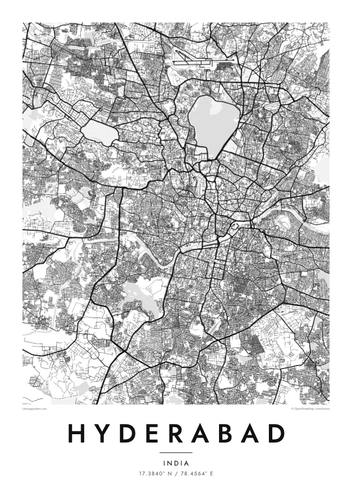
Hyderabad sits on the Deccan Plateau, where rounded granite outcrops and dozens of lakes and tanks break up the street network. The Musi River crosses the city from west to east, and on the map it marks a clear boundary: south of it lies the old city founded in 1591, north of it the areas that grew under the Nizams and in the decades since.
At the heart of the old city stands the Charminar, the four-minaret monument from which the original streets were laid out, with markets such as Laad Bazaar branching off nearby. To the north, Hussain Sagar lake forms a large body of water between Hyderabad and its twin city Secunderabad, with the Tank Bund road running along its eastern embankment.
West of the centre, the landscape changes again. The ruins of Golconda Fort occupy a hill surrounded by old lanes, and further out the technology district known as HITEC City brings wide roads and large campuses. A Hyderabad map poster holds all of this together, ringed by the Outer Ring Road that now circles the metropolitan area.
A sixteenth-century artificial lake near the centre of the map, with a large statue of the Buddha on an island and the Tank Bund road along its eastern side.
Four arches and minarets at a crossroads from which the historic streets radiate, surrounded by one of the densest and most intricate street patterns in the city.
A winding river running west to east through the city, crossed by a series of bridges and separating the older southern quarters from the newer districts to the north.
Make it yours
Add a date, a name or a line of your own, switch style, size or orientation.
The free preview is low-resolution with a watermark. Prints and HD files are rendered at 300 DPI, up to 7,200 × 10,800 px, without a watermark.
Why Hyderabad
Hyderabad holds strong personal meaning for many people, whether they know it through family in the old city, years of study, or a career in the western tech districts. The map shows both worlds at once, and the lakes give it a calm balance that works well on a wall.
The title, subtitle and coordinates line can all be changed, so the poster can carry a name, a date or a neighbourhood. Choose among five styles, from Paper to Blueprint. Printed posters come on matte paper with an optional wooden frame, shipped through partners in more than 30 countries.
Order the Hyderabad poster| Print size | Resolution | Files |
|---|---|---|
| 30 × 40 cm11.8 × 15.7″ | 3,543 × 4,724 px | PNG · PDF |
| 29.7 × 42 cm (A3)11.7 × 16.5″ | 3,508 × 4,961 px | PNG · PDF |
| 42 × 59.4 cm (A2)16.5 × 23.4″ | 4,961 × 7,016 px | PNG · PDF |
| 45.7 × 61 cm18 × 24″ | 5,400 × 7,200 px | PNG · PDF |
| 50 × 70 cm19.7 × 27.6″ | 5,906 × 8,268 px | PNG · PDF |
| 61 × 91.4 cm24 × 36″ | 7,200 × 10,800 px | PNG · PDF |
For comparison, the free preview is 900 px wide, watermarked and meant for screens. The HD files have up to 8× the resolution in each direction and print cleanly at full poster size.
Pick a style at the top of the page, then choose Printed Poster — a size and, if you like, a frame — or Digital HD Files. Checkout takes one step, and your order page updates as soon as the payment goes through.
It is printed on premium 200 gsm matte paper in one of six sizes, from 30 × 40 cm to 24 × 36″. Printed posters start at $39, shipping included.
Yes. Choose a solid wood frame in black, white, natural oak or dark wood. It comes with shatterproof glazing and is ready to hang. Framed posters start at $99, shipping included.
Shipping is free to 60+ countries. Each poster is printed by the nearest of our print partners in 30+ countries and usually arrives in 3–7 business days. You can follow the status and tracking under My Orders. A few countries take 2–5 weeks, and where we don't ship yet, the site tells you before you pay.
Send us a photo within 14 days of delivery and we will reprint it for free or refund you.
Yes. In the editor on this page, change the title, the subtitle and the coordinates line to anything you like, and pick a style and size. Printed, framed and digital orders all use exactly your design.
For $9 you get 300 DPI PNG and print-ready PDF files in all six sizes, without a watermark, to print anywhere. Not sure yet? Download a free watermarked preview first.
Nearby
