Reclaimed bayfront
The Tokyo Bay edge is made of rectangular landfill blocks separated by narrow channels, part of the Keiyo industrial zone. From above it forms the sharpest, most regular outline anywhere in the city.
Minimalist map poster · Japan
35.5167° N / 140.0833° E
A long city stretching from the refinery piers of Tokyo Bay up the winding Yoro River into the wooded Boso hills.

One city, five moods
Tap a style to see it on the wall. Every style costs the same — printed, framed or as HD files.
 Actual pixels · 24 × 36″ print file
Print-sharp
This is a 100% crop of the real print file. Every poster — printed, framed or downloaded — is rendered on our servers at 300 DPI, up to 7,200 × 10,800 pixels, so even the smallest lanes stay crisp on a 24 × 36″ print.
On the wall
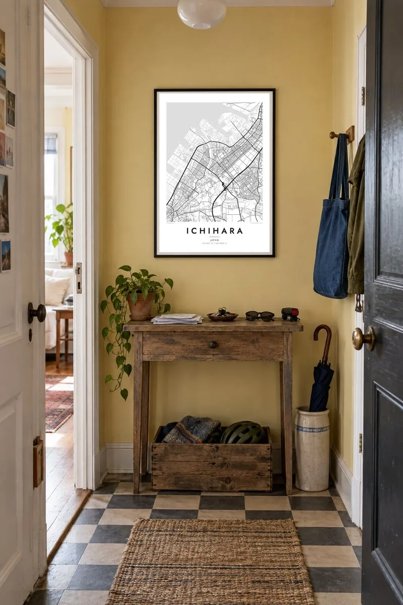


The map
Ichihara is the largest municipality in Chiba Prefecture by area, and on a map it reads as two different places joined together. Along Tokyo Bay the shoreline is squared off into reclaimed industrial land, with straight quays, tank farms and rail sidings forming a hard geometric edge. Inland, the pattern loosens into rice fields, residential estates and roads that follow valleys rather than a grid.
The Yoro River is the thread that ties the two halves together. It rises in the hills of the Boso Peninsula and loops north through narrow gorges before reaching the bay. A cliff on its banks gave its name to the Chibanian, a stage of geological time recognised internationally in 2020, which makes a quiet stretch of riverbank in Ichihara unusually well known among earth scientists.
An Ichihara map poster captures that contrast in plain line work: the dense, rectilinear waterfront in the north, the station clusters along the JR Uchibo Line, and the thinning web of lanes toward the south, where the single-track Kominato Railway threads into the hills. In black and white, the coast looks almost engineered, while the interior looks drawn by water.
The Tokyo Bay edge is made of rectangular landfill blocks separated by narrow channels, part of the Keiyo industrial zone. From above it forms the sharpest, most regular outline anywhere in the city.
South of the urban area the river bends in tight meanders through steep, wooded valleys. On the map these loops read as a nervous, hand-drawn line against the calmer pattern of the coastal plain.
A single-track local line runs from Goi station deep into the interior, linking small stations and villages. Its thin line through open country is one of the few steady marks among the hills.
Make it yours
Add a date, a name or a line of your own, switch style, size or orientation.
The free preview is low-resolution with a watermark. Prints and HD files are rendered at 300 DPI, up to 7,200 × 10,800 px, without a watermark.
Why Ichihara
Ichihara suits people with a working connection to the bay, from plant engineers to families who have commuted along the Uchibo Line for decades, and anyone who has hiked the Yoro Valley. The map holds both sides of that life in one frame, which gives it more to look at than a typical suburban plan.
You can set your own title, subtitle and coordinates line, adding a neighbourhood, a date or a short note. Choose from five styles, Classic black & white, Noir, Paper, Blueprint or Sand, then download the $9 HD files in six sizes or order a matte print with an optional wooden frame.
Order the Ichihara poster| Print size | Resolution | Files |
|---|---|---|
| 30 × 40 cm11.8 × 15.7″ | 3,543 × 4,724 px | PNG · PDF |
| 29.7 × 42 cm (A3)11.7 × 16.5″ | 3,508 × 4,961 px | PNG · PDF |
| 42 × 59.4 cm (A2)16.5 × 23.4″ | 4,961 × 7,016 px | PNG · PDF |
| 45.7 × 61 cm18 × 24″ | 5,400 × 7,200 px | PNG · PDF |
| 50 × 70 cm19.7 × 27.6″ | 5,906 × 8,268 px | PNG · PDF |
| 61 × 91.4 cm24 × 36″ | 7,200 × 10,800 px | PNG · PDF |
For comparison, the free preview is 900 px wide, watermarked and meant for screens. The HD files have up to 8× the resolution in each direction and print cleanly at full poster size.
Pick a style at the top of the page, then choose Printed Poster — a size and, if you like, a frame — or Digital HD Files. Checkout takes one step, and your order page updates as soon as the payment goes through.
It is printed on premium 200 gsm matte paper in one of six sizes, from 30 × 40 cm to 24 × 36″. Printed posters start at $39, shipping included.
Yes. Choose a solid wood frame in black, white, natural oak or dark wood. It comes with shatterproof glazing and is ready to hang. Framed posters start at $99, shipping included.
Shipping is free to 60+ countries. Each poster is printed by the nearest of our print partners in 30+ countries and usually arrives in 3–7 business days. You can follow the status and tracking under My Orders. A few countries take 2–5 weeks, and where we don't ship yet, the site tells you before you pay.
Send us a photo within 14 days of delivery and we will reprint it for free or refund you.
Yes. In the editor on this page, change the title, the subtitle and the coordinates line to anything you like, and pick a style and size. Printed, framed and digital orders all use exactly your design.
For $9 you get 300 DPI PNG and print-ready PDF files in all six sizes, without a watermark, to print anywhere. Not sure yet? Download a free watermarked preview first.
Nearby
