Barranco de Guayadeque
A deep ravine winds down from the interior on Ingenio's southern edge, its narrow road and scattered cave houses tracing a sinuous line across the map.
Minimalist map poster · Spain
27.9185° N / 15.4343° W
A municipality on Gran Canaria's dry eastern side, running from ravines in the hills down to the Atlantic coast.

One city, five moods
Tap a style to see it on the wall. Every style costs the same — printed, framed or as HD files.
 Actual pixels · 24 × 36″ print file
Print-sharp
This is a 100% crop of the real print file. Every poster — printed, framed or downloaded — is rendered on our servers at 300 DPI, up to 7,200 × 10,800 pixels, so even the smallest lanes stay crisp on a 24 × 36″ print.
On the wall
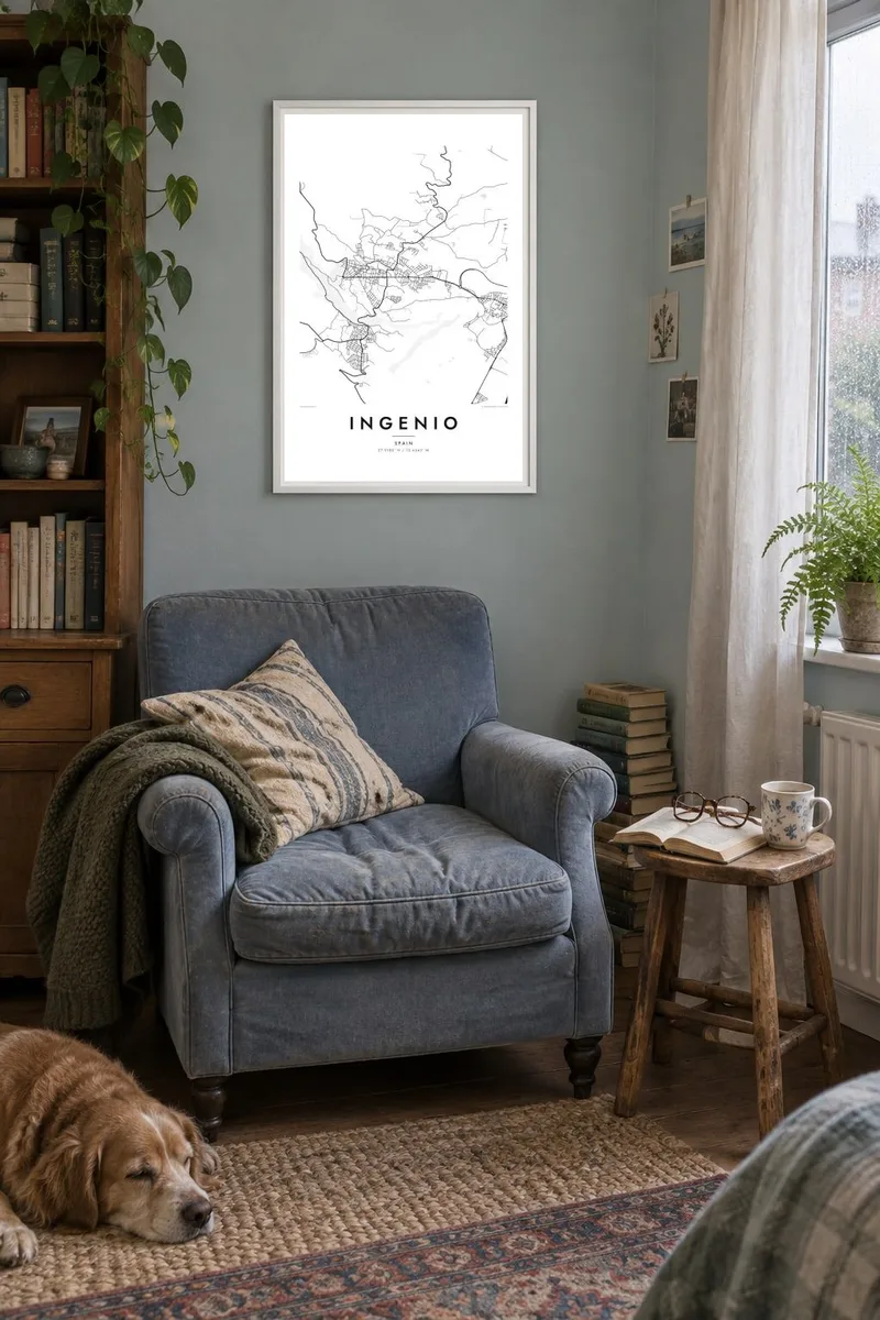


The map
Ingenio lies on the eastern side of Gran Canaria, a long municipality that runs from the island's hilly interior down toward the Atlantic. Its name refers to the sugar mills, or ingenios, that operated here after the Castilian conquest. The main town sits on the slope, its streets bending around the terrain, while the coastal district of Carrizal spreads out on the flatter land below.
The most dramatic feature is the Barranco de Guayadeque, a deep ravine shared with neighbouring Agüimes, where cave dwellings and pre-Hispanic sites line the walls and some houses and restaurants are still built into the rock. Ingenio also has a long tradition of hand embroidery and openwork, and the municipality lies close to Gran Canaria Airport and the motorway along the east coast.
An Ingenio map poster reads from mountains to sea. The ravines cut long, branching grooves down the slope, the town streets bend around them, and the coastal district and motorway form straighter lines near the shore. It is a strongly directional composition, very different from a flat town, and it captures the character of Gran Canaria's volcanic eastern side.
A deep ravine winds down from the interior on Ingenio's southern edge, its narrow road and scattered cave houses tracing a sinuous line across the map.
The main town climbs the slope in irregular streets that bend around the terrain, giving the centre a compact, knotted pattern rather than a grid.
Down near the sea, the Carrizal district spreads across flatter ground in more regular blocks, crossed by the east coast motorway and bordered by the Atlantic.
Make it yours
Add a date, a name or a line of your own, switch style, size or orientation.
The free preview is low-resolution with a watermark. Prints and HD files are rendered at 300 DPI, up to 7,200 × 10,800 px, without a watermark.
Why Ingenio
Ingenio appeals to islanders who grew up on these slopes and to visitors who walked Guayadeque or flew into Gran Canaria nearby. The map shows the island's relief through the shape of its streets and ravines, something a photograph rarely conveys.
Add your own title and subtitle, a date and the coordinates. Sand suits the dry eastern slopes, while Noir makes the ravines stand out. Download all six sizes for $9, or order a matte print with an optional wooden frame.
Order the Ingenio poster| Print size | Resolution | Files |
|---|---|---|
| 30 × 40 cm11.8 × 15.7″ | 3,543 × 4,724 px | PNG · PDF |
| 29.7 × 42 cm (A3)11.7 × 16.5″ | 3,508 × 4,961 px | PNG · PDF |
| 42 × 59.4 cm (A2)16.5 × 23.4″ | 4,961 × 7,016 px | PNG · PDF |
| 45.7 × 61 cm18 × 24″ | 5,400 × 7,200 px | PNG · PDF |
| 50 × 70 cm19.7 × 27.6″ | 5,906 × 8,268 px | PNG · PDF |
| 61 × 91.4 cm24 × 36″ | 7,200 × 10,800 px | PNG · PDF |
For comparison, the free preview is 900 px wide, watermarked and meant for screens. The HD files have up to 8× the resolution in each direction and print cleanly at full poster size.
Pick a style at the top of the page, then choose Printed Poster — a size and, if you like, a frame — or Digital HD Files. Checkout takes one step, and your order page updates as soon as the payment goes through.
It is printed on premium 200 gsm matte paper in one of six sizes, from 30 × 40 cm to 24 × 36″. Printed posters start at $39, shipping included.
Yes. Choose a solid wood frame in black, white, natural oak or dark wood. It comes with shatterproof glazing and is ready to hang. Framed posters start at $99, shipping included.
Shipping is free to 60+ countries. Each poster is printed by the nearest of our print partners in 30+ countries and usually arrives in 3–7 business days. You can follow the status and tracking under My Orders. A few countries take 2–5 weeks, and where we don't ship yet, the site tells you before you pay.
Send us a photo within 14 days of delivery and we will reprint it for free or refund you.
Yes. In the editor on this page, change the title, the subtitle and the coordinates line to anything you like, and pick a style and size. Printed, framed and digital orders all use exactly your design.
For $9 you get 300 DPI PNG and print-ready PDF files in all six sizes, without a watermark, to print anywhere. Not sure yet? Download a free watermarked preview first.
Nearby
