Historic grid
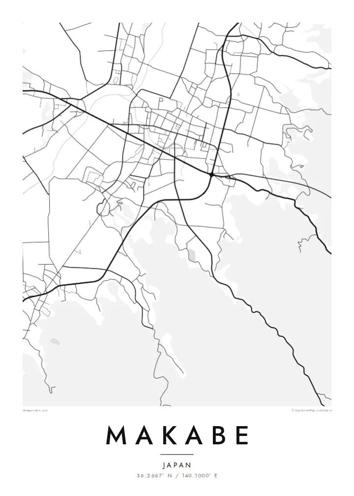
The old centre follows a compact, rectangular layout inherited from its castle-town past, lined with storehouses and traditional shop houses.
Minimalist map poster · Japan
36.2667° N / 140.1000° E
An old merchant town at the foot of Mount Tsukuba, its lanes of storehouses set among the rice fields of Ibaraki.
One city, five moods
Tap a style to see it on the wall. Every style costs the same — printed, framed or as HD files.
 Actual pixels · 24 × 36″ print file
Print-sharp
This is a 100% crop of the real print file. Every poster — printed, framed or downloaded — is rendered on our servers at 300 DPI, up to 7,200 × 10,800 pixels, so even the smallest lanes stay crisp on a 24 × 36″ print.
On the wall


The map
Makabe was a town in Ibaraki Prefecture until 2005, when it merged into the city of Sakuragawa, and it remains a distinct district with its own character. It lies on the northern side of Mount Tsukuba, where the Kanto Plain begins to meet the hills. From above the old centre is a compact grid of streets surrounded by rice paddies, farmhouses and the slopes rising to the south.
The town developed as a castle town and later as a merchant centre, and many traditional buildings survive, including storehouses and shop houses. The area is also known for its granite and stone carving. The historic district is protected as a preservation area for groups of traditional buildings, and on a map it reads as a tidy, rectangular pattern set within open fields.
Each year in late winter the district holds a Hina doll festival, when residents display dolls in the windows of old houses and shops and visitors walk the preserved streets. A Makabe map poster frames the historic centre with the fields and the northern slopes of Tsukuba around it, capturing both the town and its setting.
The old centre follows a compact, rectangular layout inherited from its castle-town past, lined with storehouses and traditional shop houses.
Flat fields surround the town in small rectangular plots, giving the map a fine, regular texture that frames the built-up area.
To the south the land rises toward Mount Tsukuba, one of the best-known mountains of the Kanto region, adding contour and depth to a wider view.
Make it yours
Add a date, a name or a line of your own, switch style, size or orientation.
The free preview is low-resolution with a watermark. Prints and HD files are rendered at 300 DPI, up to 7,200 × 10,800 px, without a watermark.
Why Makabe
Makabe suits anyone who has walked its old streets during the doll festival, grew up in the district or has family in Sakuragawa. Its compact centre and the fields around it make an elegant, balanced composition on any wall.
Set the title and subtitle, perhaps 'Makabe, Sakuragawa' or a family name and date, and edit the coordinates line. All five styles, Classic black & white, Noir, Paper, Blueprint and Sand, suit the fine grid, and Paper gives it a quiet, printed-book feel.
Order the Makabe poster| Print size | Resolution | Files |
|---|---|---|
| 30 × 40 cm11.8 × 15.7″ | 3,543 × 4,724 px | PNG · PDF |
| 29.7 × 42 cm (A3)11.7 × 16.5″ | 3,508 × 4,961 px | PNG · PDF |
| 42 × 59.4 cm (A2)16.5 × 23.4″ | 4,961 × 7,016 px | PNG · PDF |
| 45.7 × 61 cm18 × 24″ | 5,400 × 7,200 px | PNG · PDF |
| 50 × 70 cm19.7 × 27.6″ | 5,906 × 8,268 px | PNG · PDF |
| 61 × 91.4 cm24 × 36″ | 7,200 × 10,800 px | PNG · PDF |
For comparison, the free preview is 900 px wide, watermarked and meant for screens. The HD files have up to 8× the resolution in each direction and print cleanly at full poster size.
Pick a style at the top of the page, then choose Printed Poster — a size and, if you like, a frame — or Digital HD Files. Checkout takes one step, and your order page updates as soon as the payment goes through.
It is printed on premium 200 gsm matte paper in one of six sizes, from 30 × 40 cm to 24 × 36″. Printed posters start at $39, shipping included.
Yes. Choose a solid wood frame in black, white, natural oak or dark wood. It comes with shatterproof glazing and is ready to hang. Framed posters start at $99, shipping included.
Shipping is free to 60+ countries. Each poster is printed by the nearest of our print partners in 30+ countries and usually arrives in 3–7 business days. You can follow the status and tracking under My Orders. A few countries take 2–5 weeks, and where we don't ship yet, the site tells you before you pay.
Send us a photo within 14 days of delivery and we will reprint it for free or refund you.
Yes. In the editor on this page, change the title, the subtitle and the coordinates line to anything you like, and pick a style and size. Printed, framed and digital orders all use exactly your design.
For $9 you get 300 DPI PNG and print-ready PDF files in all six sizes, without a watermark, to print anywhere. Not sure yet? Download a free watermarked preview first.
Nearby
