The coastal road
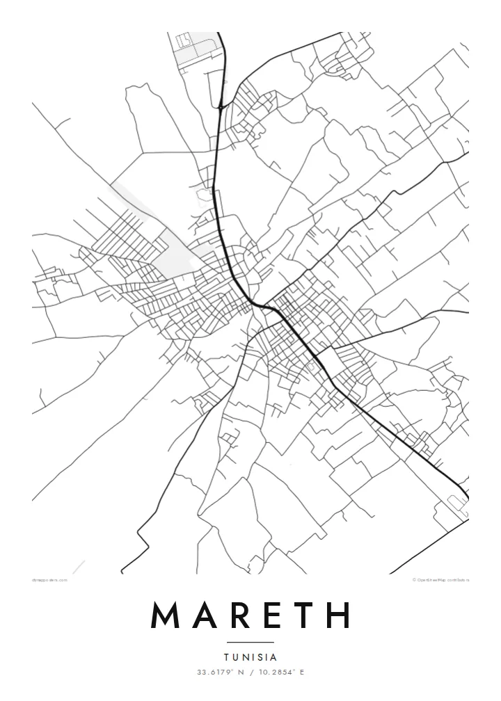
A main north–south route runs through Mareth, linking it to Gabès and the south. On the poster it becomes the strongest single line, and the rest of the town is arranged along it.
Minimalist map poster · Tunisia
33.6179° N / 10.2854° E
A low oasis town on the coastal plain of southern Tunisia, its streets gathered between palm gardens, a dry riverbed and the open road north.
One city, five moods
Tap a style to see it on the wall. Every style costs the same — printed, framed or as HD files.
 Actual pixels · 24 × 36″ print file
Print-sharp
This is a 100% crop of the real print file. Every poster — printed, framed or downloaded — is rendered on our servers at 300 DPI, up to 7,200 × 10,800 pixels, so even the smallest lanes stay crisp on a 24 × 36″ print.
On the wall


The map
Mareth sits a short distance inland from the Gulf of Gabès, on the flat strip of land between the sea and the Matmata hills. From above, the town is a loose cluster of streets set among cultivated plots and palm groves, with the main road running through it. Around the edge, the pattern thins into field boundaries and scattered buildings instead of stopping at a hard line.
The name is best known from the Second World War. Before the war, French engineers built the Mareth Line, a chain of fortifications running from the coast to the hills. In March 1943 it was the scene of heavy fighting between the British Eighth Army and Axis forces. The Wadi Zigzaou, a natural obstacle in that defensive line, still cuts across the landscape near the town.
A Mareth map poster turns this quiet geography into line work: the through-road, the tight grain of the older lanes and the looser pattern of streets and plots around them. Water shows up on a map here in a particular way. It follows seasonal wadis, not rivers, and the poster keeps those faint channels next to the denser street network.
A main north–south route runs through Mareth, linking it to Gabès and the south. On the poster it becomes the strongest single line, and the rest of the town is arranged along it.
This seasonal watercourse near the town was part of the Mareth Line's defences in 1943. On a map it reads as a thin, winding channel through otherwise flat ground.
Where the streets end, garden plots and palm groves take over. The grid loosens into irregular parcels, which gives the poster a soft, uneven border and no sharp city limit.
Make it yours
Add a date, a name or a line of your own, switch style, size or orientation.
The free preview is low-resolution with a watermark. Prints and HD files are rendered at 300 DPI, up to 7,200 × 10,800 px, without a watermark.
Why Mareth
For some people Mareth is home or a family town in the Gabès region. For others it is a name from military history they have read about or visited. A map of it is a plain, unsentimental way to keep that connection on the wall, drawn from the street pattern itself.
You can personalise the title, subtitle and coordinates line, for example with a family name or a year that matters. Choose from five styles: Classic black & white, Noir, Paper, Blueprint or Sand. Sand suits the southern Tunisian setting especially well.
Order the Mareth poster| Print size | Resolution | Files |
|---|---|---|
| 30 × 40 cm11.8 × 15.7″ | 3,543 × 4,724 px | PNG · PDF |
| 29.7 × 42 cm (A3)11.7 × 16.5″ | 3,508 × 4,961 px | PNG · PDF |
| 42 × 59.4 cm (A2)16.5 × 23.4″ | 4,961 × 7,016 px | PNG · PDF |
| 45.7 × 61 cm18 × 24″ | 5,400 × 7,200 px | PNG · PDF |
| 50 × 70 cm19.7 × 27.6″ | 5,906 × 8,268 px | PNG · PDF |
| 61 × 91.4 cm24 × 36″ | 7,200 × 10,800 px | PNG · PDF |
For comparison, the free preview is 900 px wide, watermarked and meant for screens. The HD files have up to 8× the resolution in each direction and print cleanly at full poster size.
Pick a style at the top of the page, then choose Printed Poster — a size and, if you like, a frame — or Digital HD Files. Checkout takes one step, and your order page updates as soon as the payment goes through.
It is printed on premium 200 gsm matte paper in one of six sizes, from 30 × 40 cm to 24 × 36″. Printed posters start at $39, shipping included.
Yes. Choose a solid wood frame in black, white, natural oak or dark wood. It comes with shatterproof glazing and is ready to hang. Framed posters start at $99, shipping included.
Shipping is free to 60+ countries. Each poster is printed by the nearest of our print partners in 30+ countries and usually arrives in 3–7 business days. You can follow the status and tracking under My Orders. A few countries take 2–5 weeks, and where we don't ship yet, the site tells you before you pay.
Send us a photo within 14 days of delivery and we will reprint it for free or refund you.
Yes. In the editor on this page, change the title, the subtitle and the coordinates line to anything you like, and pick a style and size. Printed, framed and digital orders all use exactly your design.
For $9 you get 300 DPI PNG and print-ready PDF files in all six sizes, without a watermark, to print anywhere. Not sure yet? Download a free watermarked preview first.
Nearby
