Twin acropolis hills
Two low hills at the heart of town bend the streets around them. The centre has an organic, uneven outline that sets it apart from typical grid-planned towns.
Minimalist map poster · Greece
37.9947° N / 23.3432° E
An ancient Attic town rising over two low hills, with orchards and a coastal plain running down to the Saronic Gulf.

One city, five moods
Tap a style to see it on the wall. Every style costs the same — printed, framed or as HD files.
 Actual pixels · 24 × 36″ print file
Print-sharp
This is a 100% crop of the real print file. Every poster — printed, framed or downloaded — is rendered on our servers at 300 DPI, up to 7,200 × 10,800 pixels, so even the smallest lanes stay crisp on a 24 × 36″ print.
On the wall
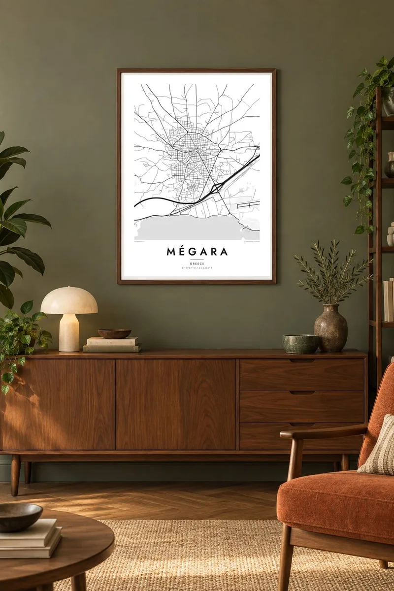


The map
Mégara lies in western Attica, on a fertile plain between Athens and the Isthmus of Corinth. On a map, the town gathers around two low hills that served as its ancient acropolises. Streets climb and bend around them, and the pattern becomes more regular in the newer districts across the flatter ground. Beyond the built-up area, a patchwork of fields and olive groves slopes gently toward the sea.
In antiquity Megara was an independent city-state, and a busy colonising one. Megarian settlers founded Byzantium, the city that later became Constantinople and then Istanbul. The philosopher Euclid of Megara, a student of Socrates, came from here. Little of the classical city is visible on a modern street map, but the hills that anchored it still shape the town today.
To the south, roads lead down to the coast and a small harbour on the Saronic Gulf. Along the plain run the modern motorway and railway between Athens and the Peloponnese. A Mégara map poster brings these layers together: an old hill town, farmland spread around it, and the broad transport lines of the present day passing along the edge.
Two low hills at the heart of town bend the streets around them. The centre has an organic, uneven outline that sets it apart from typical grid-planned towns.
Fields and groves cover the gentle slope down to the Saronic Gulf. They create a calm band of open land between the town and the shore.
The motorway and rail line pass south of the town in long, straight strokes. They tie Mégara to the wider map of Greece.
Make it yours
Add a date, a name or a line of your own, switch style, size or orientation.
The free preview is low-resolution with a watermark. Prints and HD files are rendered at 300 DPI, up to 7,200 × 10,800 px, without a watermark.
Why Mégara
A map of Mégara appeals to anyone who knows the town's quiet present, and to readers of Greek history who know that the founders of Byzantium set out from here. It also makes a good gift for families with roots in the area.
Personalise the title in Greek or English, add a subtitle and coordinates, and choose Classic black & white, Noir, Paper, Blueprint or Sand. You can download files for six sizes, or order a matte print with an optional wooden frame.
Order the Mégara poster| Print size | Resolution | Files |
|---|---|---|
| 30 × 40 cm11.8 × 15.7″ | 3,543 × 4,724 px | PNG · PDF |
| 29.7 × 42 cm (A3)11.7 × 16.5″ | 3,508 × 4,961 px | PNG · PDF |
| 42 × 59.4 cm (A2)16.5 × 23.4″ | 4,961 × 7,016 px | PNG · PDF |
| 45.7 × 61 cm18 × 24″ | 5,400 × 7,200 px | PNG · PDF |
| 50 × 70 cm19.7 × 27.6″ | 5,906 × 8,268 px | PNG · PDF |
| 61 × 91.4 cm24 × 36″ | 7,200 × 10,800 px | PNG · PDF |
For comparison, the free preview is 900 px wide, watermarked and meant for screens. The HD files have up to 8× the resolution in each direction and print cleanly at full poster size.
Pick a style at the top of the page, then choose Printed Poster — a size and, if you like, a frame — or Digital HD Files. Checkout takes one step, and your order page updates as soon as the payment goes through.
It is printed on premium 200 gsm matte paper in one of six sizes, from 30 × 40 cm to 24 × 36″. Printed posters start at $39, shipping included.
Yes. Choose a solid wood frame in black, white, natural oak or dark wood. It comes with shatterproof glazing and is ready to hang. Framed posters start at $99, shipping included.
Shipping is free to 60+ countries. Each poster is printed by the nearest of our print partners in 30+ countries and usually arrives in 3–7 business days. You can follow the status and tracking under My Orders. A few countries take 2–5 weeks, and where we don't ship yet, the site tells you before you pay.
Send us a photo within 14 days of delivery and we will reprint it for free or refund you.
Yes. In the editor on this page, change the title, the subtitle and the coordinates line to anything you like, and pick a style and size. Printed, framed and digital orders all use exactly your design.
For $9 you get 300 DPI PNG and print-ready PDF files in all six sizes, without a watermark, to print anywhere. Not sure yet? Download a free watermarked preview first.
Nearby
