Livadia bay
The main harbour faces a broad bay on the east coast, and its curve holds the island's largest cluster of streets. It is the natural focal point, where the ferries arrive.
Poster minimalist tal-mappa · il-Greċja
36.4293° N / 27.3717° E
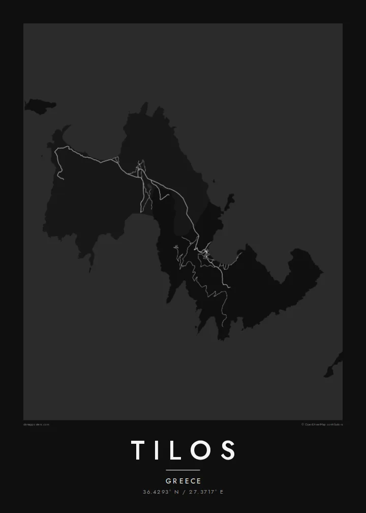
A slim, mountainous Dodecanese island with a deep bay at Livadia and an inland village linked by a winding road.



Belt waħda, ħames atmosferi
Agħfas fuq stil biex tarah fuq il-ħajt. Kull stil jiswa l-istess — stampat, inkurnat jew bħala fajls HD.
 Pixels reali · fajl tal-istampar 24 × 36″
Preċiż għall-istampar
Dan huwa qtugħ ta' 100% mill-fajl tal-istampar reali. Kull poster — stampat, inkurnat jew iddawnlowdjat — jiġi ġġenerat fuq is-servers tagħna b'300 DPI, sa 7,200 × 10,800 pixel, biex saħansitra l-iżgħar toroq jibqgħu ċari fuq stampa ta' 24 × 36″.
Fuq il-ħajt


Il-mappa
Tilos lies between Rhodes and Kos in the Dodecanese, a narrow island of bare ridges and small valleys. On a map its outline is ragged, cut into by bays on both coasts. The harbour at Livadia sits on a wide bay on the east side. Megalo Chorio, the main village, lies inland to the west and is joined to the port by a road that winds through the hills.
For a small island, Tilos has an outsized place in natural history. Remains of dwarf elephants were found in the Charkadio cave, among the most recent of their kind in Europe. In recent decades Tilos has also become known for protecting its wildlife and for a renewable energy project that aimed to power the island largely with wind and sun.
A Tilos map poster captures the island at a readable scale. The whole coastline fits easily on the sheet, and the few roads, the lanes of the two villages and the curve of each bay add just enough detail. Nothing crowds the composition, and the broken edges of the island look especially clean in black and white.
The main harbour faces a broad bay on the east coast, and its curve holds the island's largest cluster of streets. It is the natural focal point, where the ferries arrive.
The main village sits inland below a hill crowned by a medieval castle. Its compact lanes form a tight knot of lines well away from the sea.
Beyond Megalo Chorio, a road runs down a valley to the long beach at Eristos, one of the few places where the rugged coastline opens into a wide cove.
Agħmlu tiegħek
Żid data, isem jew sentenza tiegħek, ibdel l-istil, id-daqs jew l-orjentazzjoni.
Il-preview b'xejn hija b'riżoluzzjoni baxxa u bil-watermark. L-istampi u l-fajls HD jiġu ġġenerati b'300 DPI, sa 7,200 × 10,800 px, mingħajr watermark.
Għaliex Tilos
People who have spent slow summers on Tilos tend to remember it by its walks and its quiet. A map of the island keeps the shape of those days: the bay you arrived in, the village you climbed to and the road between them. It suits a kitchen or hallway as easily as a living room.
You can rename the poster, put a date in the subtitle or adjust the coordinates line, then pick Classic black & white, Noir, Paper, Blueprint or Sand. Paper and Sand suit the Aegean light. A free 900 px watermarked preview lets you check the layout before you buy the $9 HD files.
Ordna l-poster Tilos| Daqs tal-istampa | Riżoluzzjoni | Fajls |
|---|---|---|
| 30 × 40 cm (11.8 × 15.7″) | 3,543 × 4,724 px | PNG · PDF |
| 29.7 × 42 cm (A3, 11.7 × 16.5″) | 3,508 × 4,961 px | PNG · PDF |
| 42 × 59.4 cm (A2, 16.5 × 23.4″) | 4,961 × 7,016 px | PNG · PDF |
| 45.7 × 61 cm (18 × 24″) | 5,400 × 7,200 px | PNG · PDF |
| 50 × 70 cm (19.7 × 27.6″) | 5,906 × 8,268 px | PNG · PDF |
| 61 × 91.4 cm (24 × 36″) | 7,200 × 10,800 px | PNG · PDF |
Għal paragun, il-preview b'xejn huwa wiesa' 900 px, għandu watermark u huwa maħsub għall-iskrins. Il-fajls HD għandhom sa 8× ir-riżoluzzjoni f'kull direzzjoni u jiġu stampati b'mod nadif fid-daqs sħiħ tal-poster.
Agħżel stil fin-naħa ta' fuq tal-paġna, imbagħad agħżel Poster Stampat — daqs u, jekk trid, kurniċa — jew Fajls Diġitali HD. Il-ħlas isir f'pass wieħed, u l-paġna tal-ordni tiegħek tiġi aġġornata malli l-ħlas jgħaddi.
Jiġi stampat fuq karta matte premium ta' 200 gsm f'wieħed minn sitt daqsijiet, minn 30 × 40 cm sa 24 × 36″. Il-posters stampati jibdew minn {printFrom}, bil-kunsinna inkluża.
Iva. Agħżel kurniċa tal-injam solidu f'iswed, abjad, ballut naturali jew injam skur. Tiġi bi ħġieġ li ma jinkisirx u lesta biex tittella'. Il-posters inkurnati jibdew minn {framedFrom}, bil-kunsinna inkluża.
Il-kunsinna hija b'xejn madwar id-dinja. Kull poster jiġi stampat mill-eqreb sieħeb tal-istampar tagħna f'aktar minn 30 pajjiż u ġeneralment jasal fi 3–7 ijiem tax-xogħol. Tista' ssegwi l-istatus u t-tracking taħt L-Ordnijiet Tiegħi.
Ibgħatilna ritratt fi żmien 14-il jum mill-kunsinna u aħna nistampawh mill-ġdid b'xejn jew nirrimborżawk.
Iva. Fl-editur ta' din il-paġna, biddel it-titlu, is-sottotitlu u l-linja tal-koordinati għal kwalunkwe ħaġa trid, u agħżel stil u daqs. L-ordnijiet stampati, inkurnati u diġitali kollha jużaw eżattament id-disinn tiegħek.
Għal $9 tikseb fajls PNG b'300 DPI u PDF lesti għall-istampar fis-sitt daqsijiet kollha, mingħajr watermark, biex tistampa kullimkien. Għadek mhux ċert? L-ewwel iddawnlowdja preview b'xejn bil-watermark.
