Mountain valleys
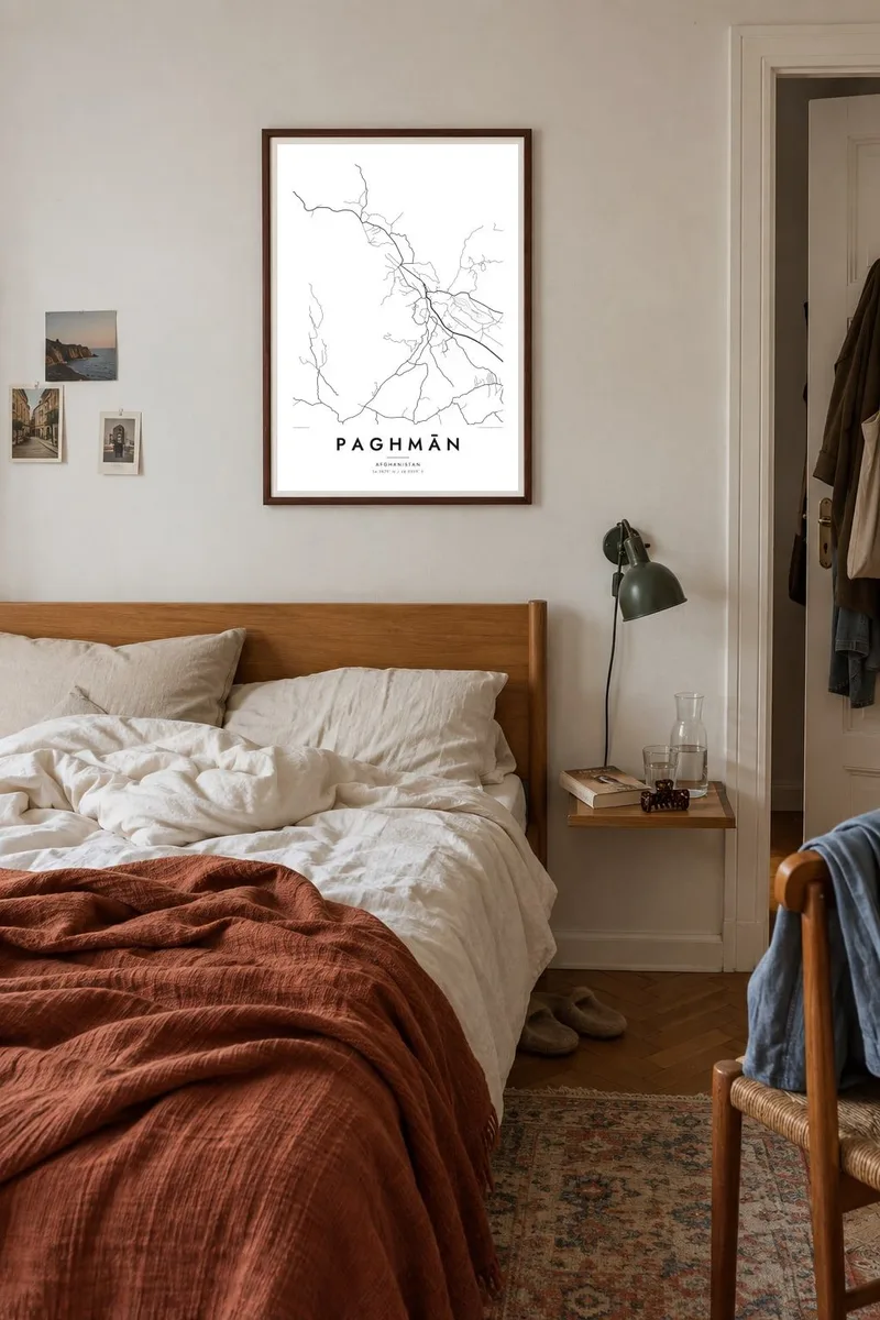
Valleys descend from the Paghman range into the town. Roads and houses follow them closely, giving the map a branching, downhill structure that reflects the terrain.
Minimalist map poster · Afghanistan
34.5879° N / 68.9509° E
A hill town west of Kabul at the foot of the Paghman range, its streets and gardens following valleys down from the mountains.

One city, five moods
Tap a style to see it on the wall. Every style costs the same — printed, framed or as HD files.
 Actual pixels · 24 × 36″ print file
Print-sharp
This is a 100% crop of the real print file. Every poster — printed, framed or downloaded — is rendered on our servers at 300 DPI, up to 7,200 × 10,800 pixels, so even the smallest lanes stay crisp on a 24 × 36″ print.
On the wall


The map
Paghmān lies a short distance west of Kabul, at the foot of the Paghman Mountains. The town occupies sloping ground where valleys open out from the range, and on a map its streets follow that terrain, running downhill from the higher ground toward the plain. Orchards, gardens and irrigated fields fill the spaces between the built-up areas.
For much of the twentieth century Paghmān was a summer retreat for Kabul, with gardens and residences built on its cooler slopes. Its best-known landmark is the Taq-e Zafar, a victory arch built in the 1920s under King Amanullah Khan to commemorate Afghan independence. A Paghmān map poster shows the town as an open, spread-out place rather than a dense city.
The layout follows water and slope more than any plan: roads follow streams and irrigation channels, and houses cluster along them. Above the town, the network thins quickly as the mountains rise. In black and white, the map reads as a set of lines coming down from the heights, a clear picture of how the town fits its setting.
Valleys descend from the Paghman range into the town. Roads and houses follow them closely, giving the map a branching, downhill structure that reflects the terrain.
The victory arch from the 1920s stands in the town as a symbol of Afghan independence. It sits within Paghmān's network of roads and gardens.
Walled gardens and orchards fill much of the land between the streets. On the poster, they create open, quiet areas that separate the clusters of houses.
Make it yours
Add a date, a name or a line of your own, switch style, size or orientation.
The free preview is low-resolution with a watermark. Prints and HD files are rendered at 300 DPI, up to 7,200 × 10,800 px, without a watermark.
Why Paghmān
Many Afghans have warm memories of Paghmān: summer picnics, gardens and cool air above Kabul. For families now living far away, a map of the town is a quiet way to keep that connection close.
Write your own title, with a subtitle and coordinates line beneath, perhaps a family name or a year. Choose from five styles, including Paper and Sand, and download the HD files in six sizes for $9 or order a printed poster.
Order the Paghmān poster| Print size | Resolution | Files |
|---|---|---|
| 30 × 40 cm11.8 × 15.7″ | 3,543 × 4,724 px | PNG · PDF |
| 29.7 × 42 cm (A3)11.7 × 16.5″ | 3,508 × 4,961 px | PNG · PDF |
| 42 × 59.4 cm (A2)16.5 × 23.4″ | 4,961 × 7,016 px | PNG · PDF |
| 45.7 × 61 cm18 × 24″ | 5,400 × 7,200 px | PNG · PDF |
| 50 × 70 cm19.7 × 27.6″ | 5,906 × 8,268 px | PNG · PDF |
| 61 × 91.4 cm24 × 36″ | 7,200 × 10,800 px | PNG · PDF |
For comparison, the free preview is 900 px wide, watermarked and meant for screens. The HD files have up to 8× the resolution in each direction and print cleanly at full poster size.
Pick a style at the top of the page, then choose Printed Poster — a size and, if you like, a frame — or Digital HD Files. Checkout takes one step, and your order page updates as soon as the payment goes through.
It is printed on premium 200 gsm matte paper in one of six sizes, from 30 × 40 cm to 24 × 36″. Printed posters start at $39, shipping included.
Yes. Choose a solid wood frame in black, white, natural oak or dark wood. It comes with shatterproof glazing and is ready to hang. Framed posters start at $99, shipping included.
Shipping is free to 60+ countries. Each poster is printed by the nearest of our print partners in 30+ countries and usually arrives in 3–7 business days. You can follow the status and tracking under My Orders. A few countries take 2–5 weeks, and where we don't ship yet, the site tells you before you pay.
Send us a photo within 14 days of delivery and we will reprint it for free or refund you.
Yes. In the editor on this page, change the title, the subtitle and the coordinates line to anything you like, and pick a style and size. Printed, framed and digital orders all use exactly your design.
For $9 you get 300 DPI PNG and print-ready PDF files in all six sizes, without a watermark, to print anywhere. Not sure yet? Download a free watermarked preview first.
Nearby
