Grid and square
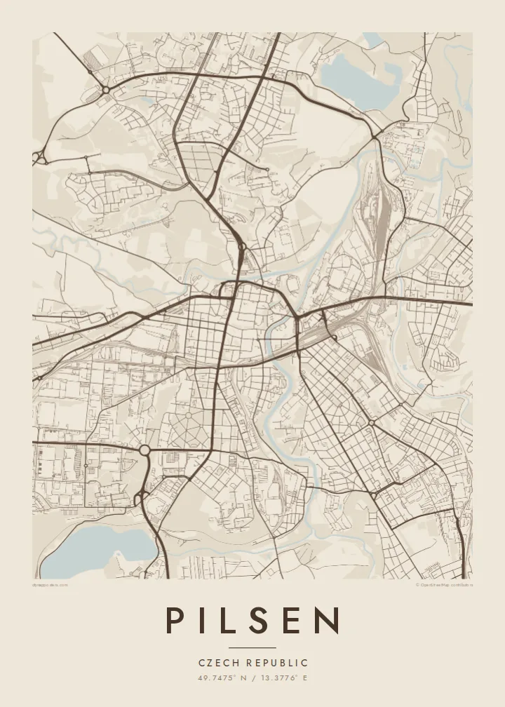
The medieval old town is a regular grid around a very large central square. It is one of the clearest planned historic cores in Central Europe.
Minimalist map poster · Czech Republic
49.7475° N / 13.3776° E
A square old town inside a ring of parks, where four rivers meet in the heart of western Bohemia.


One city, five moods
Tap a style to see it on the wall. Every style costs the same — printed, framed or as HD files.
 Actual pixels · 24 × 36″ print file
Print-sharp
This is a 100% crop of the real print file. Every poster — printed, framed or downloaded — is rendered on our servers at 300 DPI, up to 7,200 × 10,800 pixels, so even the smallest lanes stay crisp on a 24 × 36″ print.
On the wall


The map
Pilsen, Plzeň in Czech, grew up where four rivers meet: the Mže, Radbuza, Úhlava and Úslava. Below the city they join to form the Berounka. From above, their curving valleys divide the city into sections and bring green strips deep into its centre. In the middle is the medieval old town, laid out in the 13th century as a clear grid of streets around one very large square.
The old town walls were replaced by a ring of parks and avenues, and on a map this shows as a green frame around the historic grid. On the main square stands the Cathedral of St Bartholomew, whose spire is the tallest church tower in the Czech Republic. East of the centre is the brewery where pale Pilsner lager was first brewed in 1842. The large Škoda works, founded here, spread out along the rivers.
A Pilsen map poster shows the city's ordered medieval core and the four winding rivers around it. The regular grid inside its park ring sits at the centre, while the river valleys curve outward and the housing districts extend up the surrounding slopes. It is a well-balanced composition for anyone who studied, worked or lived in the city, and for anyone who simply likes a good beer.
The medieval old town is a regular grid around a very large central square. It is one of the clearest planned historic cores in Central Europe.
Parks and avenues built where the town walls once stood surround the old town in a green band that is easy to see on the map.
The Mže, Radbuza, Úhlava and Úslava wind through the city before they merge. Their valleys give Pilsen its branching outline.
Make it yours
Add a date, a name or a line of your own, switch style, size or orientation.
The free preview is low-resolution with a watermark. Prints and HD files are rendered at 300 DPI, up to 7,200 × 10,800 px, without a watermark.
Why Pilsen
Pilsen is a city people get attached to, whether as a university town, a brewing destination or a place where family lives. The square old town and the rivers make it easy to recognise on a wall.
You can personalise the title, subtitle and coordinates, for example to mark a graduation or a first visit. There are five styles: Classic black & white, Noir, Paper, Blueprint and Sand. Printed posters come on matte paper with an optional wooden frame.
Order the Pilsen poster| Print size | Resolution | Files |
|---|---|---|
| 30 × 40 cm (11.8 × 15.7″) | 3,543 × 4,724 px | PNG · PDF |
| 29.7 × 42 cm (A3, 11.7 × 16.5″) | 3,508 × 4,961 px | PNG · PDF |
| 42 × 59.4 cm (A2, 16.5 × 23.4″) | 4,961 × 7,016 px | PNG · PDF |
| 45.7 × 61 cm (18 × 24″) | 5,400 × 7,200 px | PNG · PDF |
| 50 × 70 cm (19.7 × 27.6″) | 5,906 × 8,268 px | PNG · PDF |
| 61 × 91.4 cm (24 × 36″) | 7,200 × 10,800 px | PNG · PDF |
For comparison, the free preview is 900 px wide, watermarked and meant for screens. The HD files have up to 8× the resolution in each direction and print cleanly at full poster size.
Pick a style at the top of the page, then choose Printed Poster — a size and, if you like, a frame — or Digital HD Files. Checkout takes one step, and your order page updates as soon as the payment goes through.
It is printed on premium 200 gsm matte paper in one of six sizes, from 30 × 40 cm to 24 × 36″. Printed posters start at {printFrom}, shipping included.
Yes. Choose a solid wood frame in black, white, natural oak or dark wood. It comes with shatterproof glazing and is ready to hang. Framed posters start at {framedFrom}, shipping included.
Shipping is free worldwide. Each poster is printed by the nearest of our print partners in 30+ countries and usually arrives in 3–7 business days. You can follow the status and tracking under My Orders.
Send us a photo within 14 days of delivery and we will reprint it for free or refund you.
Yes. In the editor on this page, change the title, the subtitle and the coordinates line to anything you like, and pick a style and size. Printed, framed and digital orders all use exactly your design.
For $9 you get 300 DPI PNG and print-ready PDF files in all six sizes, without a watermark, to print anywhere. Not sure yet? Download a free watermarked preview first.
Nearby
