Valiasr Street
A single avenue running roughly north to south across the whole city, from the railway station area up into the foothills near Tajrish, visible on the map as a long, almost unbroken line.
Minimalist map poster · Iran
35.6944° N / 51.4215° E
A vast city tilted against the Alborz mountains, its long avenues running downhill from the northern foothills to the southern plain.
One city, five moods
Tap a style to see it on the wall. Every style costs the same — printed, framed or as HD files.
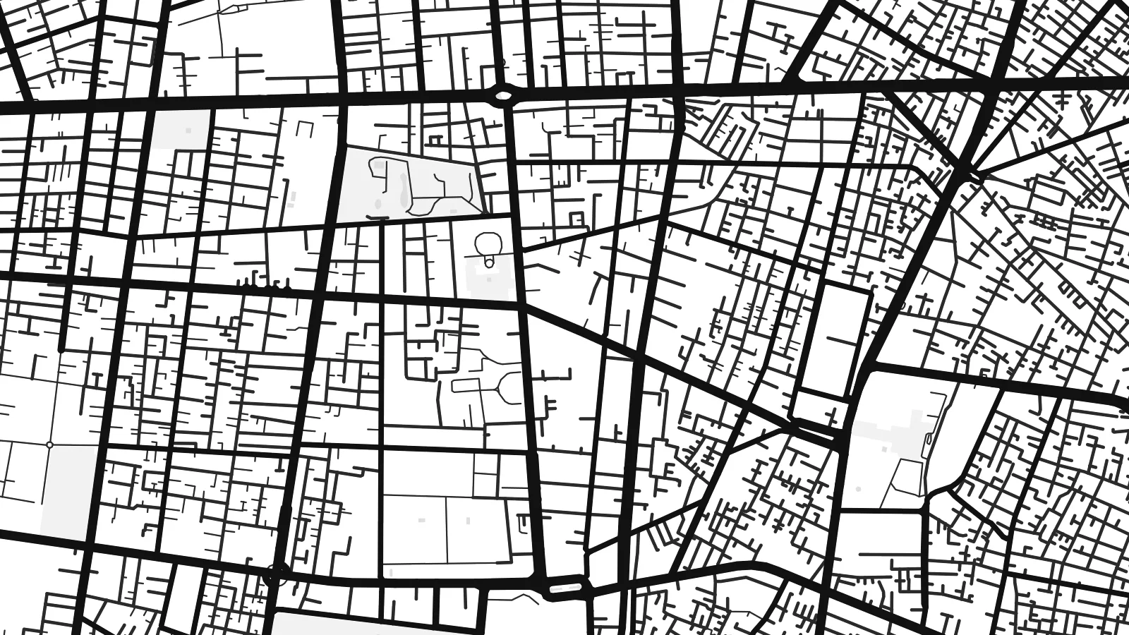 Actual pixels · 24 × 36″ print file
Print-sharp
This is a 100% crop of the real print file. Every poster — printed, framed or downloaded — is rendered on our servers at 300 DPI, up to 7,200 × 10,800 pixels, so even the smallest lanes stay crisp on a 24 × 36″ print.
On the wall


The map
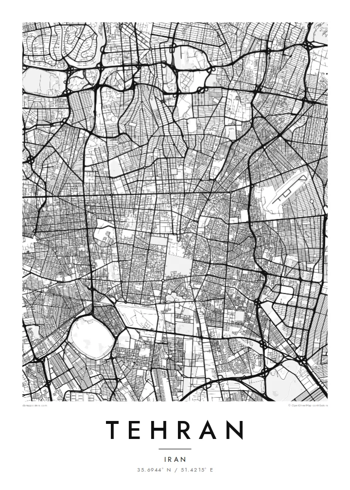
Tehran spreads across a gentle slope at the foot of the Alborz range, and that incline shapes almost everything on the map. The northern districts fold into mountain valleys and winding roads, while the south opens onto flat land where streets settle into a broader, more regular pattern. Dry riverbeds and green corridors run north to south, following the way water once came down from the peaks.
Cutting through the city from top to bottom is Valiasr Street, often described as one of the longest avenues in the Middle East and lined with old plane trees. Around it, a dense web of expressways divides the city into large blocks, while the Grand Bazaar in the south keeps the narrow, covered passages of the older town.
Tehran became the capital in the late eighteenth century under the Qajar dynasty and has grown many times over since. A Tehran map poster shows that growth as layers: the tight core near the bazaar, the planned twentieth-century districts, and the expressways reaching west toward Azadi Tower and Mehrabad airport.
A single avenue running roughly north to south across the whole city, from the railway station area up into the foothills near Tajrish, visible on the map as a long, almost unbroken line.
A large oval junction in western Tehran, built around the Azadi Tower of 1971, where several major roads converge on the approach from Mehrabad airport.
The northern edge of the map, where the regular street network breaks into winding lanes and valleys as the city climbs toward the mountains that frame its skyline.
Make it yours
Add a date, a name or a line of your own, switch style, size or orientation.
The free preview is low-resolution with a watermark. Prints and HD files are rendered at 300 DPI, up to 7,200 × 10,800 px, without a watermark.
Why Tehran
For people who grew up in Tehran or left it for somewhere else, the map is instantly familiar: the long avenues, the expressway loops, the mountains along the top edge. It is a large, detailed city, and it rewards the bigger formats such as 50×70 cm or 24×36″.
Personalise the title, the subtitle and the coordinates line to mark a neighbourhood, a wedding year or a family story, then pick one of five styles. Noir works well for the dense street web, while Sand gives it a warmer tone. Digital files are $9, with a free watermarked preview first.
Order the Tehran poster| Print size | Resolution | Files |
|---|---|---|
| 30 × 40 cm11.8 × 15.7″ | 3,543 × 4,724 px | PNG · PDF |
| 29.7 × 42 cm (A3)11.7 × 16.5″ | 3,508 × 4,961 px | PNG · PDF |
| 42 × 59.4 cm (A2)16.5 × 23.4″ | 4,961 × 7,016 px | PNG · PDF |
| 45.7 × 61 cm18 × 24″ | 5,400 × 7,200 px | PNG · PDF |
| 50 × 70 cm19.7 × 27.6″ | 5,906 × 8,268 px | PNG · PDF |
| 61 × 91.4 cm24 × 36″ | 7,200 × 10,800 px | PNG · PDF |
For comparison, the free preview is 900 px wide, watermarked and meant for screens. The HD files have up to 8× the resolution in each direction and print cleanly at full poster size.
Pick a style at the top of the page, then choose Printed Poster — a size and, if you like, a frame — or Digital HD Files. Checkout takes one step, and your order page updates as soon as the payment goes through.
It is printed on premium 200 gsm matte paper in one of six sizes, from 30 × 40 cm to 24 × 36″. Printed posters start at $39, shipping included.
Yes. Choose a solid wood frame in black, white, natural oak or dark wood. It comes with shatterproof glazing and is ready to hang. Framed posters start at $99, shipping included.
Shipping is free to 60+ countries. Each poster is printed by the nearest of our print partners in 30+ countries and usually arrives in 3–7 business days. You can follow the status and tracking under My Orders. A few countries take 2–5 weeks, and where we don't ship yet, the site tells you before you pay.
Send us a photo within 14 days of delivery and we will reprint it for free or refund you.
Yes. In the editor on this page, change the title, the subtitle and the coordinates line to anything you like, and pick a style and size. Printed, framed and digital orders all use exactly your design.
For $9 you get 300 DPI PNG and print-ready PDF files in all six sizes, without a watermark, to print anywhere. Not sure yet? Download a free watermarked preview first.
Nearby
