Vaires-Torcy lakes
Large flooded gravel basins beside the Marne form broad blank shapes on the map. The adjacent nautical stadium in Vaires-sur-Marne hosted rowing and canoe events at the Paris 2024 Olympics.
Minimalist map poster · France
48.8506° N / 2.6508° E
A new-town plan above the Marne, with curving boulevards, lakes and woodland folded between railway lines and river bends

One city, five moods
Tap a style to see it on the wall. Every style costs the same — printed, framed or as HD files.
 Actual pixels · 24 × 36″ print file
Print-sharp
This is a 100% crop of the real print file. Every poster — printed, framed or downloaded — is rendered on our servers at 300 DPI, up to 7,200 × 10,800 pixels, so even the smallest lanes stay crisp on a 24 × 36″ print.
On the wall


The map
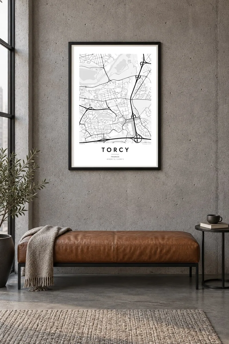
Torcy sits on the south bank of the Marne, east of Paris, in the first sector of the Marne-la-Vallée new town. From above, its planned layout is easy to see. Looping residential streets and cul-de-sacs fill the land between wooded patches. A modern town centre forms around the RER station. The old village core is small and compact, and the river and its wide leisure basin mark the northern edge.
The town is a sub-prefecture of Seine-et-Marne, and much of its fabric dates from the late twentieth century, when the new town was built on farmland and woods. That history reads clearly in line work. Main roads sweep in long arcs instead of grids. Housing clusters are set apart by green buffers. Ponds and parks appear as calm open shapes that break up the pattern of streets.
A Torcy map poster works best at a scale that shows both the river and the planned districts together. The Marne's gentle bends and the flat sheets of water at the Vaires-Torcy leisure base set a clear horizon. South of them, the curving street pattern fills the sheet with even texture. The result feels modern and orderly without being rigid.
Large flooded gravel basins beside the Marne form broad blank shapes on the map. The adjacent nautical stadium in Vaires-sur-Marne hosted rowing and canoe events at the Paris 2024 Olympics.
The river traces the town's northern limit in slow, wide bends. Its banks are lined with paths and greenery that show as a soft margin between water and streets.
Instead of a grid, the districts are threaded by looping roads and closes. This gives the poster a flowing, almost organic pattern that is typical of French villes nouvelles.
Make it yours
Add a date, a name or a line of your own, switch style, size or orientation.
The free preview is low-resolution with a watermark. Prints and HD files are rendered at 300 DPI, up to 7,200 × 10,800 px, without a watermark.
Why Torcy
People who grew up in Marne-la-Vallée, or who commute from Torcy along the RER A, often want a map that captures its unusual planned geometry. The lakes and river give the composition a natural anchor, which makes it a quiet piece for a hallway or a home office.
You can change the title, subtitle and coordinates line to mark a move, a first flat or a family address, and choose between Classic black & white, Noir, Paper, Blueprint and Sand. Blueprint suits the engineered feel of the new-town layout especially well.
Order the Torcy poster| Print size | Resolution | Files |
|---|---|---|
| 30 × 40 cm11.8 × 15.7″ | 3,543 × 4,724 px | PNG · PDF |
| 29.7 × 42 cm (A3)11.7 × 16.5″ | 3,508 × 4,961 px | PNG · PDF |
| 42 × 59.4 cm (A2)16.5 × 23.4″ | 4,961 × 7,016 px | PNG · PDF |
| 45.7 × 61 cm18 × 24″ | 5,400 × 7,200 px | PNG · PDF |
| 50 × 70 cm19.7 × 27.6″ | 5,906 × 8,268 px | PNG · PDF |
| 61 × 91.4 cm24 × 36″ | 7,200 × 10,800 px | PNG · PDF |
For comparison, the free preview is 900 px wide, watermarked and meant for screens. The HD files have up to 8× the resolution in each direction and print cleanly at full poster size.
Pick a style at the top of the page, then choose Printed Poster — a size and, if you like, a frame — or Digital HD Files. Checkout takes one step, and your order page updates as soon as the payment goes through.
It is printed on premium 200 gsm matte paper in one of six sizes, from 30 × 40 cm to 24 × 36″. Printed posters start at $39, shipping included.
Yes. Choose a solid wood frame in black, white, natural oak or dark wood. It comes with shatterproof glazing and is ready to hang. Framed posters start at $99, shipping included.
Shipping is free to 60+ countries. Each poster is printed by the nearest of our print partners in 30+ countries and usually arrives in 3–7 business days. You can follow the status and tracking under My Orders. A few countries take 2–5 weeks, and where we don't ship yet, the site tells you before you pay.
Send us a photo within 14 days of delivery and we will reprint it for free or refund you.
Yes. In the editor on this page, change the title, the subtitle and the coordinates line to anything you like, and pick a style and size. Printed, framed and digital orders all use exactly your design.
For $9 you get 300 DPI PNG and print-ready PDF files in all six sizes, without a watermark, to print anywhere. Not sure yet? Download a free watermarked preview first.
Nearby
