Haut-du-Lièvre slabs
Very long residential buildings on the plateau appear as striking linear shapes, among the most recognisable footprints in the whole Nancy area.
Minimalist map poster · France
48.6611° N / 6.1711° E
A plateau suburb above Nancy, where long housing slabs, a hospital campus and green slopes meet curving boulevards.
One city, five moods
Tap a style to see it on the wall. Every style costs the same — printed, framed or as HD files.
 Actual pixels · 24 × 36″ print file
Print-sharp
This is a 100% crop of the real print file. Every poster — printed, framed or downloaded — is rendered on our servers at 300 DPI, up to 7,200 × 10,800 pixels, so even the smallest lanes stay crisp on a 24 × 36″ print.
On the wall


The map
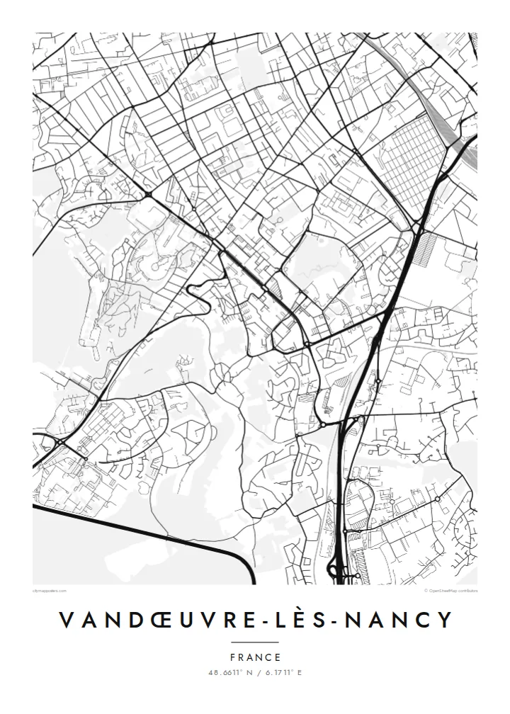
Vandœuvre-lès-Nancy lies immediately south-west of Nancy, on higher ground above the Meurthe valley. The commune grew rapidly in the second half of the twentieth century, and its map shows it: broad curving roads, large residential blocks set in open space, and older village streets tucked into the lower parts. The edge with Nancy is seamless, but the pattern changes clearly as you move uphill.
The Haut-du-Lièvre district on the plateau is known for some of the longest apartment buildings in France, slabs that read on the map as unusually long, thin shapes. Nearby, the Brabois area gathers the regional university hospital, university faculties and a botanical garden. Wooded slopes separate these areas and give the town a strong green framework between built zones.
A Vandœuvre-lès-Nancy map poster presents modern urban planning in a clear graphic language. The long slabs, the loops of access roads and the large campus footprints contrast with the tighter grid of Nancy at the edge of the frame. It is an image that suits people who studied, worked or grew up here, and anyone interested in post-war architecture.
Very long residential buildings on the plateau appear as striking linear shapes, among the most recognisable footprints in the whole Nancy area.
The university hospital, faculties and research buildings form a large campus to the south-west, with wide spacing and looping internal roads.
Green hillsides and parkland separate the plateau from the lower town, giving the map broad blank areas between denser zones.
Make it yours
Add a date, a name or a line of your own, switch style, size or orientation.
The free preview is low-resolution with a watermark. Prints and HD files are rendered at 300 DPI, up to 7,200 × 10,800 px, without a watermark.
Why Vandœuvre-lès-Nancy
Many people pass through Vandœuvre as students, hospital staff or residents, and a map of it keeps that chapter in view. The unusual building shapes also make it a strong architectural print in its own right.
Set a personal title, subtitle and coordinates, perhaps marking a graduation year. Five styles are available, Classic black and white, Noir, Paper, Blueprint and Sand, as $9 digital files in six sizes or as a printed poster.
Order the Vandœuvre-lès-Nancy poster| Print size | Resolution | Files |
|---|---|---|
| 30 × 40 cm11.8 × 15.7″ | 3,543 × 4,724 px | PNG · PDF |
| 29.7 × 42 cm (A3)11.7 × 16.5″ | 3,508 × 4,961 px | PNG · PDF |
| 42 × 59.4 cm (A2)16.5 × 23.4″ | 4,961 × 7,016 px | PNG · PDF |
| 45.7 × 61 cm18 × 24″ | 5,400 × 7,200 px | PNG · PDF |
| 50 × 70 cm19.7 × 27.6″ | 5,906 × 8,268 px | PNG · PDF |
| 61 × 91.4 cm24 × 36″ | 7,200 × 10,800 px | PNG · PDF |
For comparison, the free preview is 900 px wide, watermarked and meant for screens. The HD files have up to 8× the resolution in each direction and print cleanly at full poster size.
Pick a style at the top of the page, then choose Printed Poster — a size and, if you like, a frame — or Digital HD Files. Checkout takes one step, and your order page updates as soon as the payment goes through.
It is printed on premium 200 gsm matte paper in one of six sizes, from 30 × 40 cm to 24 × 36″. Printed posters start at $39, shipping included.
Yes. Choose a solid wood frame in black, white, natural oak or dark wood. It comes with shatterproof glazing and is ready to hang. Framed posters start at $99, shipping included.
Shipping is free to 60+ countries. Each poster is printed by the nearest of our print partners in 30+ countries and usually arrives in 3–7 business days. You can follow the status and tracking under My Orders. A few countries take 2–5 weeks, and where we don't ship yet, the site tells you before you pay.
Send us a photo within 14 days of delivery and we will reprint it for free or refund you.
Yes. In the editor on this page, change the title, the subtitle and the coordinates line to anything you like, and pick a style and size. Printed, framed and digital orders all use exactly your design.
For $9 you get 300 DPI PNG and print-ready PDF files in all six sizes, without a watermark, to print anywhere. Not sure yet? Download a free watermarked preview first.
Nearby
