Hill of Difficulty
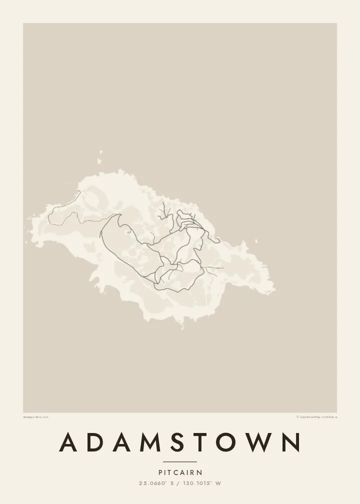
The steep track from the landing up to the village is the island's essential route, drawn on the map as a short, sharply climbing line from the shore.
Ata mapa faigafua · Pitcairn Islands
25.0660° S / 130.1015° W
The only settlement on Pitcairn, a scatter of homes and dirt tracks on green slopes high above Bounty Bay.




Kolo e tahi, lanu e nima
Tuki he sitaili ke sio ai ʻi te holo. ʻE tatau pē te totogi ʻo te sitaili fuli pē — mokā tā, fakakātoa, peʻe ko he ʻu faila HD.
 Ngaahi pikiseli moʻoni · faila tā 24 × 36″
Mahino lelei ki te pulūti
Ko he konga 100% ʻo te faila tā moʻoni ʻaeni. Ko te ʻu posita fuli pē — mokā tā, fakakātoa peʻe download — ʻe fakatupu ʻi ʻomātou seva ʻi te 300 DPI, aʻu ki te 7,200 × 10,800 pikiseli, koia ʻe nofo mahino ai te ʻu ala liliki ʻi he tā 24 × 36″.
ʻI Te Puipui


Te mapa
Adamstown is the capital and only village of the Pitcairn Islands, a British Overseas Territory in the South Pacific and one of the least populated jurisdictions in the world. The island was settled in 1790 by mutineers from HMS Bounty and the Tahitians who travelled with them, and many of today's islanders are their descendants. The village is named after John Adams, the last surviving mutineer.
On a map, Adamstown is not a grid but a loose arrangement of houses and public buildings along a network of unpaved tracks on the island's northern slopes. A steep road known as the Hill of Difficulty climbs from the landing at Bounty Bay to the village, and a few further tracks wander out across the rest of the island's small, rugged surface.
Pitcairn is volcanic and only a few square kilometres in area, with cliffs on almost every side and no harbour for large ships. An Adamstown map poster reflects that intimacy of scale: a handful of lines on a hillside and the long, rocky coast of an island where every track eventually leads back to the sea.
The steep track from the landing up to the village is the island's essential route, drawn on the map as a short, sharply climbing line from the shore.
A small cove on the northeast coast serves as the island's landing place, a modest indentation in a coastline otherwise defined by cliffs and rock.
Unpaved roads and paths spread loosely across the slopes around Adamstown, linking homes, public buildings and outlying plots in an informal, organic web.
Faʻu ke ʻau ʻa ʻau
Tuku he ʻaho, he hingoa peʻe he kiʻi palalau ʻa ʻau, fetogi te faʻahiga, te lahi peʻe te hake.
Ko te faʻata fua noa ʻe māʻulalo hono lelei pea ʻe ʻi ai he fakaʻilonga. Ko te ʻu tā mo te ʻu faila HD ʻe fakatupu ʻi te 300 DPI, aʻu ki te 7,200 × 10,800 px, ʻe mole ʻi ai he fakaʻilonga.
Koteā ko Adamstown
Adamstown is a map for people fascinated by the Bounty story, for descendants of the island families, and for those who collect the world's most remote places. Its few, almost hand-drawn lines and generous coastline make a thoughtful piece for a study or library wall.
Add a title, a subtitle or a date of your choosing, and a coordinates line, then choose Classic black & white, Noir, Paper, Blueprint or Sand. The Paper style gives it the feel of an old chart. Download for $9, or order a matte print with an optional wooden frame.
Fakatau te posita Adamstown| Lahi ʻo te pulūti | Mahino | Faile |
|---|---|---|
| 30 × 40 cm11.8 × 15.7″ | 3,543 × 4,724 px | PNG · PDF |
| 29.7 × 42 cm (A3)11.7 × 16.5″ | 3,508 × 4,961 px | PNG · PDF |
| 42 × 59.4 cm (A2)16.5 × 23.4″ | 4,961 × 7,016 px | PNG · PDF |
| 45.7 × 61 cm18 × 24″ | 5,400 × 7,200 px | PNG · PDF |
| 50 × 70 cm19.7 × 27.6″ | 5,906 × 8,268 px | PNG · PDF |
| 61 × 91.4 cm24 × 36″ | 7,200 × 10,800 px | PNG · PDF |
Ko te ata ʻe mole totogi ʻe 900 px tona laulahi, mo te fakaʻilonga, ki te sioʻata pē. Ko te ʻu faile HD ʻe aʻu ki te liuga 8 tona mahino, pea ʻe pulūti lelei ʻi te lahi kātoa.
Fili he sitaili ʻi te tuʻa ʻo te pasina, pea fili leva te Posita Tā — he lahi pea, kapau ʻe ke loto ai, he fakakātoa — peʻe ko te ʻu Faila HD Fakakomipiuta. ʻE tahi pē te sitepu ʻo te totogi, pea ʻe fakafou fakavavevave pē tau pasina fakatau mai te taimi ʻe fai ai te totogi.
ʻE tā ʻi he pepa lelei ʻaupito 200 gsm matte, ʻi he tahi ʻo te ono lahi, mai te 30 × 40 cm ki te 24 × 36″. ʻE kamata te ʻu posita tā ʻi te $39, kātoa mo te ʻave.
ʻIo. Fili he fakakātoa ʻakau moʻoni ʻi te kili, hinahina, ʻakau natula peʻe ʻakau ʻuliʻuli. ʻE ʻi ai mo he sioga mālohi ʻe mole mafesi, pea kua teu ke tautau. ʻE kamata te ʻu posita fakakātoa ʻi te $99, kātoa mo te ʻave.
Ko te fakahoko e mole totogi ki te ʼu fenua e 60+. Ko te pōsita taki taha ʼe tā e te tahi ʼo ʼemau ʼu kaufakalogo tā ʼe ofi mai, ʼi te ʼu fenua e 30+, pea ʼe hoko mai ʼi te ʼu ʼaho gaue e 3–7. ʼE feala hau ke ke vakaʼi te tuʼunga mo te tracking ʼi Oku Fakamaʼu. ʼE ʼi ai te ʼu fenua ʼe 2–5 te ʼu vaiaho, pea ʼi te ʼu fenua ʼaē ʼe heʼeki tou fakahoko ki ai, ʼe fakahā e te saite ʼi muʼa ʼo tau totogi.
Fekau mai he ʻata ʻi loto ʻi te ʻaho e 14 talu mai te aʻu mai, pea mātou toe tā noa peʻe toe totogi atu.
ʻIo. ʻI te meʻa fakatonutonu ʻi te pasina ʻaeni, fetogi te kupu tāfito, te kupu lalo pea mo te laina koʻoliteti ki he meʻa fuli pē ʻe ke loto ai, pea fili he sitaili mo he lahi. Ko te ʻu fakatau tā, fakakātoa mo fakakomipiuta ʻe fakaʻaogaʻi katoa pē tou fakatātā.
Mo te $9 ʻe ke maʻu ai te ʻu faila PNG 300 DPI mo PDF kua teu ke tā, ʻi te ono lahi kātoa, ʻe mole ʻi ai he fakaʻilonga, ke ke tā ai ʻi soʻo he potu. Kei tā fakafiafia? Download muʻa he faʻata mokā mo he fakaʻilonga, ʻe fua noa.
