Radiating main roads
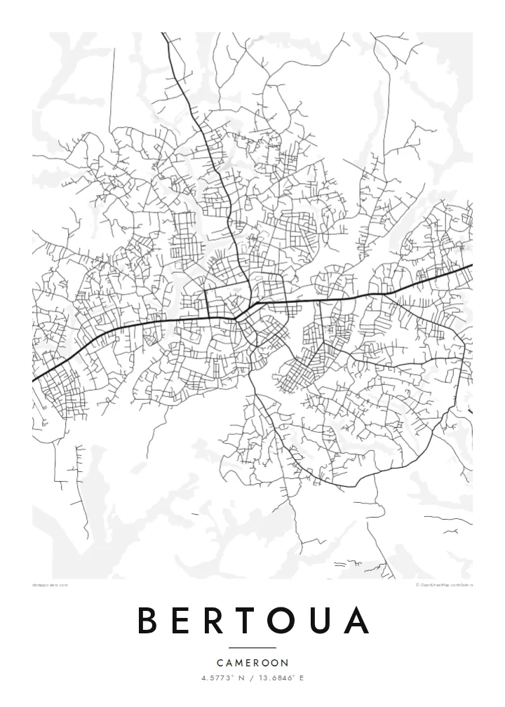
Several main routes leave the centre in different directions, and neighbourhoods have grown along each. On the map this gives Bertoua a branching, star-like outline.
Ata mapa faigafua · Cameroon
4.5773° N / 13.6846° E
A regional capital spreading out along its main roads through the rolling, forested country of eastern Cameroon


Kolo e tahi, lanu e nima
Tuki he sitaili ke sio ai ʻi te holo. ʻE tatau pē te totogi ʻo te sitaili fuli pē — mokā tā, fakakātoa, peʻe ko he ʻu faila HD.
 Ngaahi pikiseli moʻoni · faila tā 24 × 36″
Mahino lelei ki te pulūti
Ko he konga 100% ʻo te faila tā moʻoni ʻaeni. Ko te ʻu posita fuli pē — mokā tā, fakakātoa peʻe download — ʻe fakatupu ʻi ʻomātou seva ʻi te 300 DPI, aʻu ki te 7,200 × 10,800 pikiseli, koia ʻe nofo mahino ai te ʻu ala liliki ʻi he tā 24 × 36″.
ʻI Te Puipui


Te mapa
Bertoua is the capital of Cameroon's East Region, a large and thinly populated area of rainforest and savanna edge. From above, the town grows outward from a central district along its main roads. Quarters extend along each approach, and the gaps between them are filled with vegetation and small farms. The ground rises and falls gently, so streets bend to follow the terrain rather than a strict grid.
As the administrative centre of the region, Bertoua is a crossroads for travel and trade across the east. Road links head towards Yaoundé and on towards the borders with the Central African Republic and beyond. The town has grown considerably in recent decades as that role has expanded.
A Bertoua map poster shows a town still taking shape. There is a clear centre, arms of development along the main routes, and plenty of open ground between them. Rendered in black and white, the loose, branching form has an organic quality quite unlike the dense grids of coastal cities.
Several main routes leave the centre in different directions, and neighbourhoods have grown along each. On the map this gives Bertoua a branching, star-like outline.
The core of town holds the regional offices, markets and denser streets. It shows up as the most tightly drawn part of the map, surrounded by looser residential quarters.
Between and beyond the built-up areas the map opens into vegetation and small plots. These gaps give the poster breathing room and hint at the forested region around it.
Faʻu ke ʻau ʻa ʻau
Tuku he ʻaho, he hingoa peʻe he kiʻi palalau ʻa ʻau, fetogi te faʻahiga, te lahi peʻe te hake.
Ko te faʻata fua noa ʻe māʻulalo hono lelei pea ʻe ʻi ai he fakaʻilonga. Ko te ʻu tā mo te ʻu faila HD ʻe fakatupu ʻi te 300 DPI, aʻu ki te 7,200 × 10,800 px, ʻe mole ʻi ai he fakaʻilonga.
Koteā ko Bertoua
For people from the East Region, or anyone who has lived and worked in Bertoua, this map is a quiet reminder of home. Its open, branching form hangs well in a hallway, study or living room.
You can set your own title, subtitle and coordinates line and choose one of five styles: Classic black & white, Noir, Paper, Blueprint or Sand. Printed posters on matte paper, with an optional wooden frame, ship from partners in more than 30 countries.
Fakatau te posita Bertoua| Lahi ʻo te pulūti | Mahino | Faile |
|---|---|---|
| 30 × 40 cm (11.8 × 15.7″) | 3,543 × 4,724 px | PNG · PDF |
| 29.7 × 42 cm (A3, 11.7 × 16.5″) | 3,508 × 4,961 px | PNG · PDF |
| 42 × 59.4 cm (A2, 16.5 × 23.4″) | 4,961 × 7,016 px | PNG · PDF |
| 45.7 × 61 cm (18 × 24″) | 5,400 × 7,200 px | PNG · PDF |
| 50 × 70 cm (19.7 × 27.6″) | 5,906 × 8,268 px | PNG · PDF |
| 61 × 91.4 cm (24 × 36″) | 7,200 × 10,800 px | PNG · PDF |
Ko te ata ʻe mole totogi ʻe 900 px tona laulahi, mo te fakaʻilonga, ki te sioʻata pē. Ko te ʻu faile HD ʻe aʻu ki te liuga 8 tona mahino, pea ʻe pulūti lelei ʻi te lahi kātoa.
Fili he sitaili ʻi te tuʻa ʻo te pasina, pea fili leva te Posita Tā — he lahi pea, kapau ʻe ke loto ai, he fakakātoa — peʻe ko te ʻu Faila HD Fakakomipiuta. ʻE tahi pē te sitepu ʻo te totogi, pea ʻe fakafou fakavavevave pē tau pasina fakatau mai te taimi ʻe fai ai te totogi.
ʻE tā ʻi he pepa lelei ʻaupito 200 gsm matte, ʻi he tahi ʻo te ono lahi, mai te 30 × 40 cm ki te 24 × 36″. ʻE kamata te ʻu posita tā ʻi te {printFrom}, kātoa mo te ʻave.
ʻIo. Fili he fakakātoa ʻakau moʻoni ʻi te kili, hinahina, ʻakau natula peʻe ʻakau ʻuliʻuli. ʻE ʻi ai mo he sioga mālohi ʻe mole mafesi, pea kua teu ke tautau. ʻE kamata te ʻu posita fakakātoa ʻi te {framedFrom}, kātoa mo te ʻave.
ʻE fua noa te ʻave ki te lalolagi kātoa. ʻE tā takitaha posita e te kaugā tā ʻe ovi ki ai ʻi te lolotoga ʻo te ʻu puleʻanga e 30 tupu, pea ʻe aʻu mai tuʻumaʻu ʻi te ʻaho gāue e 3 ki te 7. ʻE feala ke ke sio ki te tuʻu pea mo te ʻalu ʻi lalo ʻo Taku ʻu Fakatau.
Fekau mai he ʻata ʻi loto ʻi te ʻaho e 14 talu mai te aʻu mai, pea mātou toe tā noa peʻe toe totogi atu.
ʻIo. ʻI te meʻa fakatonutonu ʻi te pasina ʻaeni, fetogi te kupu tāfito, te kupu lalo pea mo te laina koʻoliteti ki he meʻa fuli pē ʻe ke loto ai, pea fili he sitaili mo he lahi. Ko te ʻu fakatau tā, fakakātoa mo fakakomipiuta ʻe fakaʻaogaʻi katoa pē tou fakatātā.
Mo te $9 ʻe ke maʻu ai te ʻu faila PNG 300 DPI mo PDF kua teu ke tā, ʻi te ono lahi kātoa, ʻe mole ʻi ai he fakaʻilonga, ke ke tā ai ʻi soʻo he potu. Kei tā fakafiafia? Download muʻa he faʻata mokā mo he fakaʻilonga, ʻe fua noa.
