Two rivers meet
The Chari and the Logone join at the city's edge, forming a clear Y-shaped junction of water on the map that anchors the whole composition.
Ata mapa faigafua · Chad
12.1067° N / 15.0444° E
A flat Sahelian capital stretched along the Chari where it meets the Logone, facing Cameroon across the water


Kolo e tahi, lanu e nima
Tuki he sitaili ke sio ai ʻi te holo. ʻE tatau pē te totogi ʻo te sitaili fuli pē — mokā tā, fakakātoa, peʻe ko he ʻu faila HD.
 Ngaahi pikiseli moʻoni · faila tā 24 × 36″
Mahino lelei ki te pulūti
Ko he konga 100% ʻo te faila tā moʻoni ʻaeni. Ko te ʻu posita fuli pē — mokā tā, fakakātoa peʻe download — ʻe fakatupu ʻi ʻomātou seva ʻi te 300 DPI, aʻu ki te 7,200 × 10,800 pikiseli, koia ʻe nofo mahino ai te ʻu ala liliki ʻi he tā 24 × 36″.
ʻI Te Puipui


Te mapa
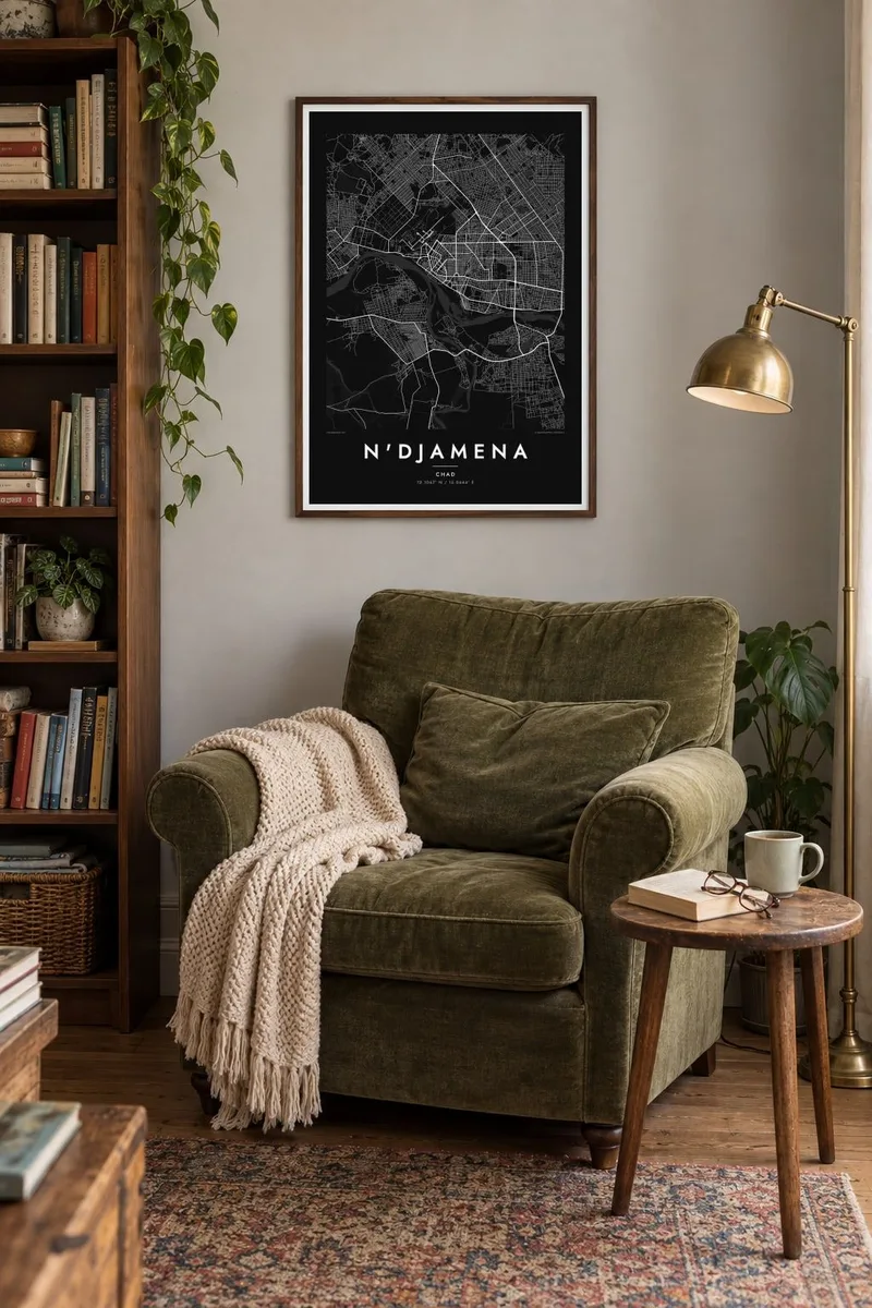
N'Djamena lies at the confluence of two rivers: the Chari, flowing from the southeast, and the Logone, arriving from the south. The city spreads along the Chari's eastern bank on a wide, flat plain, and at the confluence the Logone marks the border with Cameroon, with the town of Kousséri on the far side. On the map, water defines the city's entire western edge.
Founded by the French in 1900 as Fort-Lamy, the city was renamed N'Djamena in 1973 and is Chad's capital and largest city. Its plan shows an older administrative core near the river, with broad avenues and roundabouts, surrounded by an extensive spread of low-rise neighbourhoods laid out on a loose grid that reaches out toward the dry plains.
The two rivers here belong to the system that feeds Lake Chad, which lies further to the northwest beyond the frame. An N'Djamena map poster shows the meeting of waters, the bridges crossing the Chari to the districts on its southern side and the long, even texture of the city's quarters, a spacious composition with a single decisive natural feature.
The Chari and the Logone join at the city's edge, forming a clear Y-shaped junction of water on the map that anchors the whole composition.
Across the Logone lies Kousséri in Cameroon. Few capitals sit so directly on an international frontier, and the poster shows the two towns separated only by the river.
Bridges carry roads across the Chari to neighbourhoods on its southern bank, short straight lines that tie the two sides of the city together across the wide river.
Faʻu ke ʻau ʻa ʻau
Tuku he ʻaho, he hingoa peʻe he kiʻi palalau ʻa ʻau, fetogi te faʻahiga, te lahi peʻe te hake.
Ko te faʻata fua noa ʻe māʻulalo hono lelei pea ʻe ʻi ai he fakaʻilonga. Ko te ʻu tā mo te ʻu faila HD ʻe fakatupu ʻi te 300 DPI, aʻu ki te 7,200 × 10,800 px, ʻe mole ʻi ai he fakaʻilonga.
Koteā ko N'Djamena
N'Djamena is a map for Chadians at home and abroad, and for the aid workers, diplomats and engineers who have spent years in the city. The confluence of rivers is instantly recognisable and gives the poster a strong focal point without any need for decoration.
Personalise the title, subtitle and coordinates line with a name, a posting, a date or a phrase in French or Arabic. Choose from five styles: Classic black & white, Noir, Paper, Blueprint or Sand. Sand echoes the colours of the Sahel particularly well.
Fakatau te posita N'Djamena| Lahi ʻo te pulūti | Mahino | Faile |
|---|---|---|
| 30 × 40 cm (11.8 × 15.7″) | 3,543 × 4,724 px | PNG · PDF |
| 29.7 × 42 cm (A3, 11.7 × 16.5″) | 3,508 × 4,961 px | PNG · PDF |
| 42 × 59.4 cm (A2, 16.5 × 23.4″) | 4,961 × 7,016 px | PNG · PDF |
| 45.7 × 61 cm (18 × 24″) | 5,400 × 7,200 px | PNG · PDF |
| 50 × 70 cm (19.7 × 27.6″) | 5,906 × 8,268 px | PNG · PDF |
| 61 × 91.4 cm (24 × 36″) | 7,200 × 10,800 px | PNG · PDF |
Ko te ata ʻe mole totogi ʻe 900 px tona laulahi, mo te fakaʻilonga, ki te sioʻata pē. Ko te ʻu faile HD ʻe aʻu ki te liuga 8 tona mahino, pea ʻe pulūti lelei ʻi te lahi kātoa.
Fili he sitaili ʻi te tuʻa ʻo te pasina, pea fili leva te Posita Tā — he lahi pea, kapau ʻe ke loto ai, he fakakātoa — peʻe ko te ʻu Faila HD Fakakomipiuta. ʻE tahi pē te sitepu ʻo te totogi, pea ʻe fakafou fakavavevave pē tau pasina fakatau mai te taimi ʻe fai ai te totogi.
ʻE tā ʻi he pepa lelei ʻaupito 200 gsm matte, ʻi he tahi ʻo te ono lahi, mai te 30 × 40 cm ki te 24 × 36″. ʻE kamata te ʻu posita tā ʻi te $39, kātoa mo te ʻave.
ʻIo. Fili he fakakātoa ʻakau moʻoni ʻi te kili, hinahina, ʻakau natula peʻe ʻakau ʻuliʻuli. ʻE ʻi ai mo he sioga mālohi ʻe mole mafesi, pea kua teu ke tautau. ʻE kamata te ʻu posita fakakātoa ʻi te $99, kātoa mo te ʻave.
Ko te ʻave ʻe tuʻa totogi ʻi te malamanei katoa. Ko te pōsita ʻe tā e te kaumeʻa tā ʻoku ofi taha ʻi fenua e 30+, pea ʻe aʻu mai ʻi ʻaho gāue e 3–7. ʻE lava ke ke sivi te tuʻunga mo te tulitaki ʻi lalo ʻo Aku ʻōta. ʻE ʻi ai ni fenua ʻe uike e 2–5, pea ʻi te ʻu fenua ʻe mole te ʻave ki ai, ʻe fakahā e te sitē ʻi muʻa ʻo te totogi.
Fekau mai he ʻata ʻi loto ʻi te ʻaho e 14 talu mai te aʻu mai, pea mātou toe tā noa peʻe toe totogi atu.
ʻIo. ʻI te meʻa fakatonutonu ʻi te pasina ʻaeni, fetogi te kupu tāfito, te kupu lalo pea mo te laina koʻoliteti ki he meʻa fuli pē ʻe ke loto ai, pea fili he sitaili mo he lahi. Ko te ʻu fakatau tā, fakakātoa mo fakakomipiuta ʻe fakaʻaogaʻi katoa pē tou fakatātā.
Mo te $9 ʻe ke maʻu ai te ʻu faila PNG 300 DPI mo PDF kua teu ke tā, ʻi te ono lahi kātoa, ʻe mole ʻi ai he fakaʻilonga, ke ke tā ai ʻi soʻo he potu. Kei tā fakafiafia? Download muʻa he faʻata mokā mo he fakaʻilonga, ʻe fua noa.
