Former French Concession
In the north of the district, narrow, gently curving streets lined with plane trees form an intricate, irregular texture. It is quite unlike the straight arteries elsewhere in Shanghai.
Minimalist map poster · China
31.1959° N / 121.4471° E
Plane-tree avenues of the old French Concession, the Xujiahui crossroads and a long stretch of Huangpu riverfront

One city, five moods
Tap a style to see it on the wall. Every style costs the same — printed, framed or as HD files.
 Actual pixels · 24 × 36″ print file
Print-sharp
This is a 100% crop of the real print file. Every poster — printed, framed or downloaded — is rendered on our servers at 300 DPI, up to 7,200 × 10,800 pixels, so even the smallest lanes stay crisp on a 24 × 36″ print.
On the wall


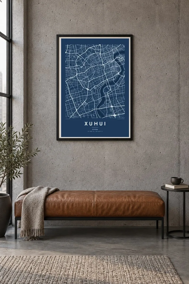
The map
Xuhui is one of Shanghai's central districts, stretching from the leafy lanes of the former French Concession south-west to the Huangpu River. Its name comes from Xujiahui, the neighbourhood where the scholar Xu Guangqi, who worked with the Jesuit Matteo Ricci, lived and was buried. Today Xujiahui is a major junction of metro lines and shopping streets, and several wide roads meet there.
The northern part of a Xuhui map poster is full of fine, curving streets such as Hengshan Road and Wukang Road, lined with plane trees, old villas and apartment houses. Further south the blocks grow larger and more regular. The district reaches the river along the West Bund, where former industrial wharves and the old Longhua airfield have become a waterfront of museums and promenades.
Two religious landmarks anchor the district's history: the twin-spired St Ignatius Cathedral at Xujiahui, built in the early twentieth century, and Longhua Temple with its pagoda further south. Between them, elevated highways and metro lines cross the grid. The result is a compact, layered map where Shanghai's colonial, religious, industrial and contemporary pasts sit side by side.
In the north of the district, narrow, gently curving streets lined with plane trees form an intricate, irregular texture. It is quite unlike the straight arteries elsewhere in Shanghai.
Several major roads meet at this busy hub. On the map they create a clear focal point where diagonal and straight avenues come together near the cathedral.
The district's long edge on the Huangpu, once lined with wharves and an airfield, now traces a clean line of riverside parks and cultural buildings.
Make it yours
Add a date, a name or a line of your own, switch style, size or orientation.
The free preview is low-resolution with a watermark. Prints and HD files are rendered at 300 DPI, up to 7,200 × 10,800 px, without a watermark.
Why Xuhui
Xuhui is where many people in Shanghai live, study or first stayed in the city, and its tree-lined streets carry strong personal memories. A map of the district makes a refined, specific alternative to a general Shanghai poster.
Add your own title, a subtitle such as a street name or a date, and choose one of five styles, from Classic black & white to Blueprint or Sand. Printed posters ship from partners in more than 30 countries, and HD files arrive instantly.
Order the Xuhui poster| Print size | Resolution | Files |
|---|---|---|
| 30 × 40 cm11.8 × 15.7″ | 3,543 × 4,724 px | PNG · PDF |
| 29.7 × 42 cm (A3)11.7 × 16.5″ | 3,508 × 4,961 px | PNG · PDF |
| 42 × 59.4 cm (A2)16.5 × 23.4″ | 4,961 × 7,016 px | PNG · PDF |
| 45.7 × 61 cm18 × 24″ | 5,400 × 7,200 px | PNG · PDF |
| 50 × 70 cm19.7 × 27.6″ | 5,906 × 8,268 px | PNG · PDF |
| 61 × 91.4 cm24 × 36″ | 7,200 × 10,800 px | PNG · PDF |
For comparison, the free preview is 900 px wide, watermarked and meant for screens. The HD files have up to 8× the resolution in each direction and print cleanly at full poster size.
Pick a style at the top of the page, then choose Printed Poster — a size and, if you like, a frame — or Digital HD Files. Checkout takes one step, and your order page updates as soon as the payment goes through.
It is printed on premium 200 gsm matte paper in one of six sizes, from 30 × 40 cm to 24 × 36″. Printed posters start at $39, shipping included.
Yes. Choose a solid wood frame in black, white, natural oak or dark wood. It comes with shatterproof glazing and is ready to hang. Framed posters start at $99, shipping included.
Shipping is free to 60+ countries. Each poster is printed by the nearest of our print partners in 30+ countries and usually arrives in 3–7 business days. You can follow the status and tracking under My Orders. A few countries take 2–5 weeks, and where we don't ship yet, the site tells you before you pay.
Send us a photo within 14 days of delivery and we will reprint it for free or refund you.
Yes. In the editor on this page, change the title, the subtitle and the coordinates line to anything you like, and pick a style and size. Printed, framed and digital orders all use exactly your design.
For $9 you get 300 DPI PNG and print-ready PDF files in all six sizes, without a watermark, to print anywhere. Not sure yet? Download a free watermarked preview first.
Nearby
