The long spine
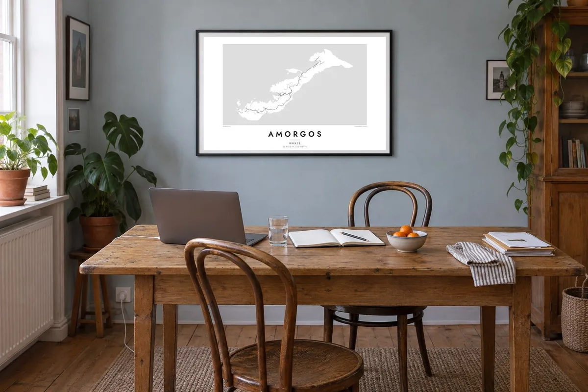
A continuous mountain ridge runs the length of the island. It gives the map a strong diagonal and splits a steep, cliff-lined southeast from a softer northwestern coast.
Minimalist map poster · Greece
36.8525° N / 25.9131° E
A long, narrow ridge of rock angled across the Aegean, with steep cliffs on one side and small harbours on the other

One city, five moods
Tap a style to see it on the wall. Every style costs the same — printed, framed or as HD files.
 Actual pixels · 24 × 36″ print file
Print-sharp
This is a 100% crop of the real print file. Every poster — printed, framed or downloaded — is rendered on our servers at 300 DPI, up to 7,200 × 10,800 pixels, so even the smallest lanes stay crisp on a 24 × 36″ print.
On the wall


The island
Amorgos is the easternmost of the Cyclades, and from above it looks less like a round island than a blade of stone about thirty kilometres long. It runs from northeast to southwest. A mountainous spine runs its whole length, and the land drops sharply to the sea along the southeastern flank. The gentler northwestern side is where the bays and landings sit.
On the map the settlements are few and clearly separated. The port of Katapola sits at the head of a deep inlet on the western coast. The whitewashed Chora lies inland on a ridge above it, and Aegiali gathers around a sandy bay in the north. Thin roads and old footpaths follow the spine between them and trace the island's long, lean outline.
The Monastery of Hozoviotissa is built directly into a sheer cliff face on the southern coast, and it is the island's best-known image. Amorgos also gained wide attention as a filming location for Luc Besson's 1988 film The Big Blue. An Amorgos map poster turns this spare geography into a clean study of a coastline, a ridge and a handful of villages.
A continuous mountain ridge runs the length of the island. It gives the map a strong diagonal and splits a steep, cliff-lined southeast from a softer northwestern coast.
The main harbour sits at the end of a sheltered inlet on the western shore, a small notch of sea cut cleanly into the island's outline.
Hozoviotissa clings to the southern cliffs below the Chora. On the map it is a tiny mark where the land falls almost vertically into the Aegean.
Make it yours
Add a date, a name or a line of your own, switch style, size or orientation.
The free preview is low-resolution with a watermark. Prints and HD files are rendered at 300 DPI, up to 7,200 × 10,800 px, without a watermark.
Why Amorgos
Some people hang this map because they walked the old paths between Chora and Aegiali. Others keep it for the memory of a slow summer at the eastern edge of the Cyclades. The single diagonal shape reads well on a wall and stays uncluttered even at small sizes.
You can add a personal title, subtitle and coordinates line, such as a date, a harbour name or the bay where you stayed. Choose from Classic black & white, Noir, Paper, Blueprint or Sand to suit the room.
Order the Amorgos poster| Print size | Resolution | Files |
|---|---|---|
| 30 × 40 cm11.8 × 15.7″ | 3,543 × 4,724 px | PNG · PDF |
| 29.7 × 42 cm (A3)11.7 × 16.5″ | 3,508 × 4,961 px | PNG · PDF |
| 42 × 59.4 cm (A2)16.5 × 23.4″ | 4,961 × 7,016 px | PNG · PDF |
| 45.7 × 61 cm18 × 24″ | 5,400 × 7,200 px | PNG · PDF |
| 50 × 70 cm19.7 × 27.6″ | 5,906 × 8,268 px | PNG · PDF |
| 61 × 91.4 cm24 × 36″ | 7,200 × 10,800 px | PNG · PDF |
For comparison, the free preview is 900 px wide, watermarked and meant for screens. The HD files have up to 8× the resolution in each direction and print cleanly at full poster size.
Pick a style at the top of the page, then choose Printed Poster — a size and, if you like, a frame — or Digital HD Files. Checkout takes one step, and your order page updates as soon as the payment goes through.
It is printed on premium 200 gsm matte paper in one of six sizes, from 30 × 40 cm to 24 × 36″. Printed posters start at $39, shipping included.
Yes. Choose a solid wood frame in black, white, natural oak or dark wood. It comes with shatterproof glazing and is ready to hang. Framed posters start at $99, shipping included.
Shipping is free to 60+ countries. Each poster is printed by the nearest of our print partners in 30+ countries and usually arrives in 3–7 business days. You can follow the status and tracking under My Orders. A few countries take 2–5 weeks, and where we don't ship yet, the site tells you before you pay.
Send us a photo within 14 days of delivery and we will reprint it for free or refund you.
Yes. In the editor on this page, change the title, the subtitle and the coordinates line to anything you like, and pick a style and size. Printed, framed and digital orders all use exactly your design.
For $9 you get 300 DPI PNG and print-ready PDF files in all six sizes, without a watermark, to print anywhere. Not sure yet? Download a free watermarked preview first.
Nearby
