Kalamos headland
A massive limestone rock forms the island's eastern tip. On the map it reads as a sharp, heavy promontory, a counterweight to the rounded hills of the rest of the island.
Minimalist map poster · Greece
36.3734° N / 25.7929° E
A small, rugged Cycladic island with a hilltop village and a great limestone headland reaching out to the southeast
One city, five moods
Tap a style to see it on the wall. Every style costs the same — printed, framed or as HD files.
 Actual pixels · 24 × 36″ print file
Print-sharp
This is a 100% crop of the real print file. Every poster — printed, framed or downloaded — is rendered on our servers at 300 DPI, up to 7,200 × 10,800 pixels, so even the smallest lanes stay crisp on a 24 × 36″ print.
On the wall


The island
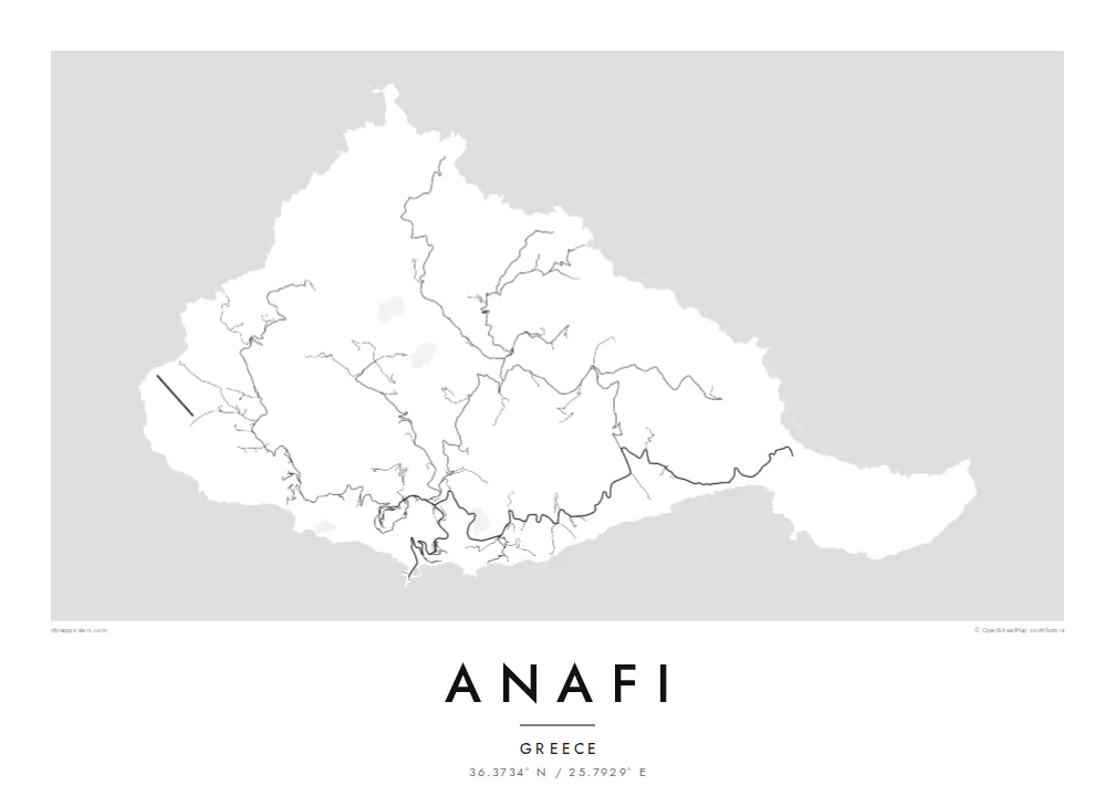
From above, Anafi looks like a compact knot of hills that ends in a long eastern arm. Roads are few and short. They climb from the small harbour to the white village of Chora on its ridge, then thin into footpaths that follow the valleys down to sheltered beaches on the south coast. Most of the island is bare slope, so the contour of the coastline carries most of the drawing.
The eastern arm ends at Kalamos, a huge limestone rock that rises straight from the sea and is often counted among the largest monoliths in the Mediterranean. A monastery sits high on its flank. In Greek myth, Apollo made the island appear out of the sea to shelter the Argonauts in a storm, and its name is usually linked to that moment of appearing.
An Anafi map poster works because there is so little on it. There is the harbour, a single winding road, the cluster of Chora and a scatter of chapels and tracks across the hills. Around it all, the Aegean fills the frame. Anafi lies just east of Santorini, but the map shows a much quieter place: an island measured in footpaths rather than streets.
A massive limestone rock forms the island's eastern tip. On the map it reads as a sharp, heavy promontory, a counterweight to the rounded hills of the rest of the island.
The main village sits high above the harbour, a tight cluster of lanes joined to the sea by one looping road. It is the densest set of lines on the whole island.
A row of small bays along the southern shore is reached by paths rather than roads. They cut a gentle scalloped edge into the coastline.
Make it yours
Add a date, a name or a line of your own, switch style, size or orientation.
The free preview is low-resolution with a watermark. Prints and HD files are rendered at 300 DPI, up to 7,200 × 10,800 px, without a watermark.
Why Anafi
Anafi tends to stay with people who went looking for the quieter end of the Cyclades, walked its paths and caught the ferry onward with some reluctance. The spare outline suits a calm wall, and the dark sea of the Noir style frames the island especially well.
Put your own words in the title and subtitle, such as the year you arrived or the name of the beach you walked to, and choose from five styles: Classic black & white, Noir, Paper, Blueprint or Sand. Download the HD files for $9, or order a matte print.
Order the Anafi poster| Print size | Resolution | Files |
|---|---|---|
| 30 × 40 cm11.8 × 15.7″ | 3,543 × 4,724 px | PNG · PDF |
| 29.7 × 42 cm (A3)11.7 × 16.5″ | 3,508 × 4,961 px | PNG · PDF |
| 42 × 59.4 cm (A2)16.5 × 23.4″ | 4,961 × 7,016 px | PNG · PDF |
| 45.7 × 61 cm18 × 24″ | 5,400 × 7,200 px | PNG · PDF |
| 50 × 70 cm19.7 × 27.6″ | 5,906 × 8,268 px | PNG · PDF |
| 61 × 91.4 cm24 × 36″ | 7,200 × 10,800 px | PNG · PDF |
For comparison, the free preview is 900 px wide, watermarked and meant for screens. The HD files have up to 8× the resolution in each direction and print cleanly at full poster size.
Pick a style at the top of the page, then choose Printed Poster — a size and, if you like, a frame — or Digital HD Files. Checkout takes one step, and your order page updates as soon as the payment goes through.
It is printed on premium 200 gsm matte paper in one of six sizes, from 30 × 40 cm to 24 × 36″. Printed posters start at $39, shipping included.
Yes. Choose a solid wood frame in black, white, natural oak or dark wood. It comes with shatterproof glazing and is ready to hang. Framed posters start at $99, shipping included.
Shipping is free to 60+ countries. Each poster is printed by the nearest of our print partners in 30+ countries and usually arrives in 3–7 business days. You can follow the status and tracking under My Orders. A few countries take 2–5 weeks, and where we don't ship yet, the site tells you before you pay.
Send us a photo within 14 days of delivery and we will reprint it for free or refund you.
Yes. In the editor on this page, change the title, the subtitle and the coordinates line to anything you like, and pick a style and size. Printed, framed and digital orders all use exactly your design.
For $9 you get 300 DPI PNG and print-ready PDF files in all six sizes, without a watermark, to print anywhere. Not sure yet? Download a free watermarked preview first.
Nearby
