Alcazaba and old quarter
The Moorish fortress on the hill, surrounded by steep, winding streets, churches and convents, forms the densest part of the map.
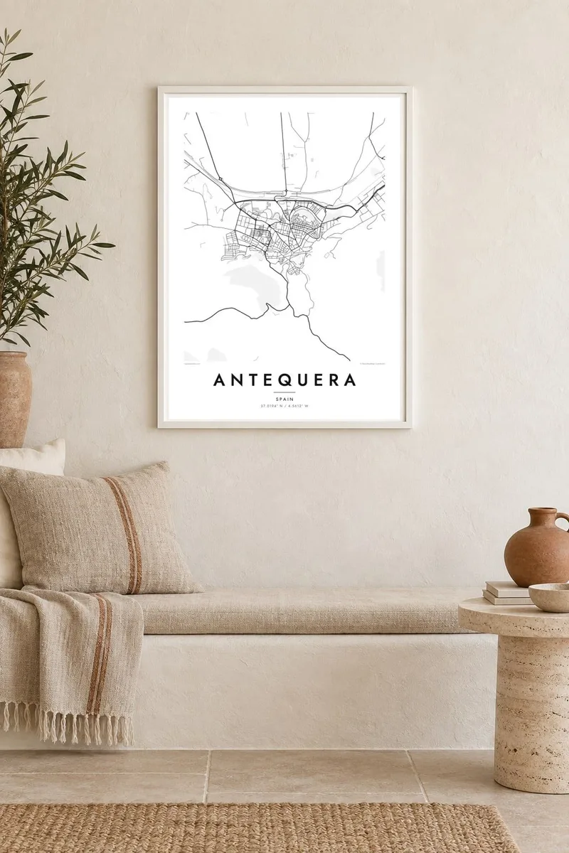
Minimalist map poster · Spain
37.0194° N / 4.5612° W
A hillside town under its Moorish fortress, with the fertile vega spread out below and limestone ridges rising to the south

One city, five moods
Tap a style to see it on the wall. Every style costs the same — printed, framed or as HD files.
 Actual pixels · 24 × 36″ print file
Print-sharp
This is a 100% crop of the real print file. Every poster — printed, framed or downloaded — is rendered on our servers at 300 DPI, up to 7,200 × 10,800 pixels, so even the smallest lanes stay crisp on a 24 × 36″ print.
On the wall


The map
Antequera climbs the northern slopes of a ridge in the heart of Andalusia. From above, the old quarter is a tight knot of streets around the Alcazaba and the Real Colegiata de Santa María. Below it, the town spreads down towards the broad, flat Vega de Antequera. The street pattern loosens as the ground levels out, and main roads fan out towards Málaga, Seville, Córdoba and Granada.
The town is known as the crossroads of Andalusia, and it has some of the oldest monuments in Europe. The Dolmens of Menga and Viera and the Tholos of El Romeral, together with the Peña de los Enamorados and the karst landscape of El Torcal, were listed by UNESCO in 2016. The rock outline of the Peña is often compared to a human face seen in profile.
An Antequera map poster sets the hilltop old town against the open plain. Narrow, curving lanes around the castle give way to wider blocks and then to the straight lines of farm tracks and highways. Out towards the edges, relief and ridges suggest the dramatic landscape that surrounds the town, even when the frame stays close to the streets.
The Moorish fortress on the hill, surrounded by steep, winding streets, churches and convents, forms the densest part of the map.
The megalithic burial mounds of Menga and Viera lie at the northeastern edge of town, part of a UNESCO World Heritage listing.
The wide agricultural plain north of the town, crossed by straight roads and rail lines that lead out towards the rest of Andalusia.
Make it yours
Add a date, a name or a line of your own, switch style, size or orientation.
The free preview is low-resolution with a watermark. Prints and HD files are rendered at 300 DPI, up to 7,200 × 10,800 px, without a watermark.
Why Antequera
Antequera suits anyone drawn to places where layers of history are visible in the street plan, from prehistoric tombs to Moorish walls and Baroque churches. It is also a practical memento of a road trip, since so many Andalusian routes pass through here.
Choose one of five styles, Classic black & white, Noir, Paper, Blueprint or Sand, and add a personal title, subtitle and coordinates. The $9 download includes 300 DPI PNG and PDF files in six sizes, or you can order a framed or unframed print.
Order the Antequera poster| Print size | Resolution | Files |
|---|---|---|
| 30 × 40 cm11.8 × 15.7″ | 3,543 × 4,724 px | PNG · PDF |
| 29.7 × 42 cm (A3)11.7 × 16.5″ | 3,508 × 4,961 px | PNG · PDF |
| 42 × 59.4 cm (A2)16.5 × 23.4″ | 4,961 × 7,016 px | PNG · PDF |
| 45.7 × 61 cm18 × 24″ | 5,400 × 7,200 px | PNG · PDF |
| 50 × 70 cm19.7 × 27.6″ | 5,906 × 8,268 px | PNG · PDF |
| 61 × 91.4 cm24 × 36″ | 7,200 × 10,800 px | PNG · PDF |
For comparison, the free preview is 900 px wide, watermarked and meant for screens. The HD files have up to 8× the resolution in each direction and print cleanly at full poster size.
Pick a style at the top of the page, then choose Printed Poster — a size and, if you like, a frame — or Digital HD Files. Checkout takes one step, and your order page updates as soon as the payment goes through.
It is printed on premium 200 gsm matte paper in one of six sizes, from 30 × 40 cm to 24 × 36″. Printed posters start at $39, shipping included.
Yes. Choose a solid wood frame in black, white, natural oak or dark wood. It comes with shatterproof glazing and is ready to hang. Framed posters start at $99, shipping included.
Shipping is free to 60+ countries. Each poster is printed by the nearest of our print partners in 30+ countries and usually arrives in 3–7 business days. You can follow the status and tracking under My Orders. A few countries take 2–5 weeks, and where we don't ship yet, the site tells you before you pay.
Send us a photo within 14 days of delivery and we will reprint it for free or refund you.
Yes. In the editor on this page, change the title, the subtitle and the coordinates line to anything you like, and pick a style and size. Printed, framed and digital orders all use exactly your design.
For $9 you get 300 DPI PNG and print-ready PDF files in all six sizes, without a watermark, to print anywhere. Not sure yet? Download a free watermarked preview first.
Nearby
