River and marshes
The Barbate river widens into tidal marshes before it meets the sea. Its branching channels create one of the most intricate and organic patterns on the poster.
Minimalist map poster · Spain
36.1924° N / 5.9219° W
A fishing town at the mouth of a marshy river on Spain's Atlantic coast, with long beaches reaching toward Cape Trafalgar

One city, five moods
Tap a style to see it on the wall. Every style costs the same — printed, framed or as HD files.
 Actual pixels · 24 × 36″ print file
Print-sharp
This is a 100% crop of the real print file. Every poster — printed, framed or downloaded — is rendered on our servers at 300 DPI, up to 7,200 × 10,800 pixels, so even the smallest lanes stay crisp on a 24 × 36″ print.
On the wall


The map
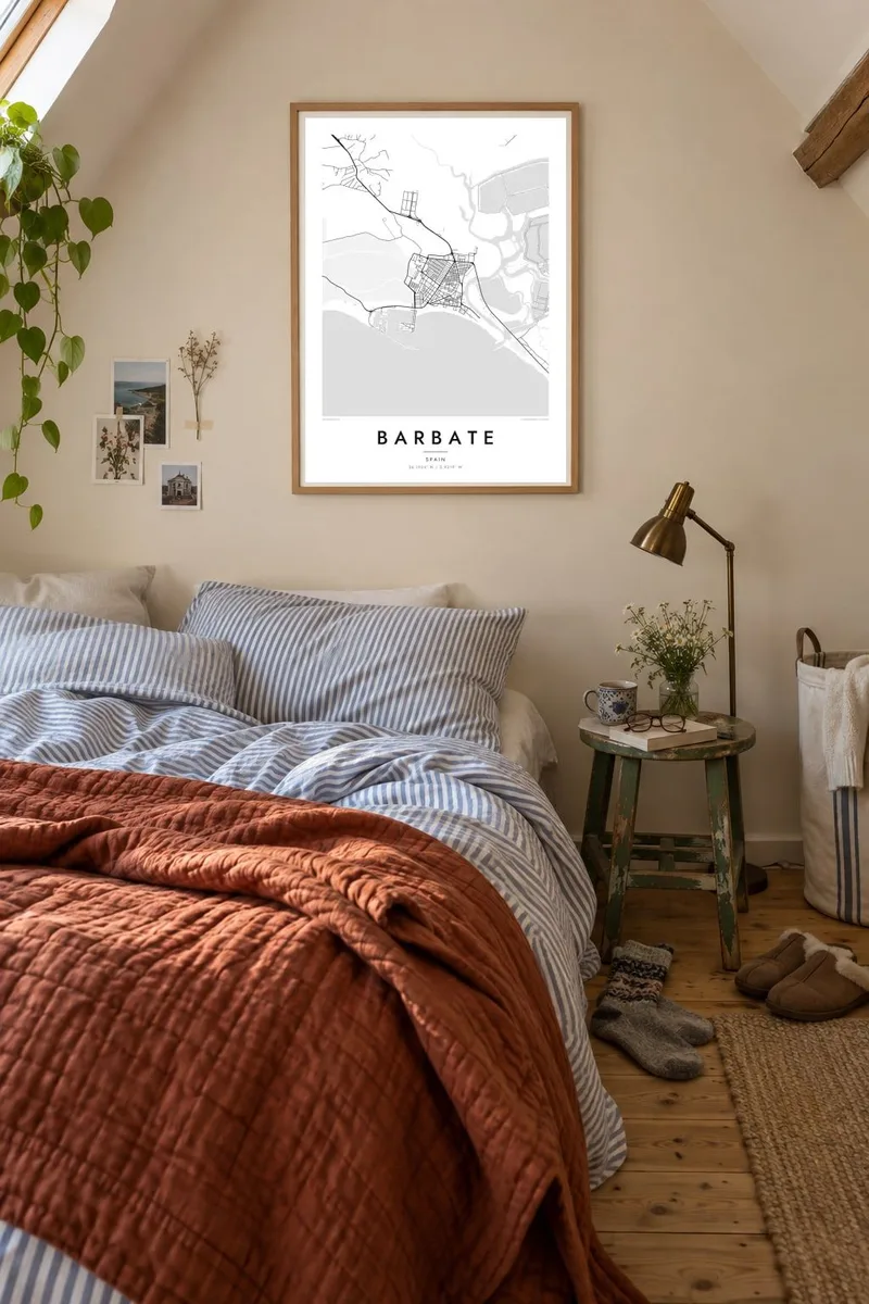
Barbate lies on the Costa de la Luz in the province of Cádiz, Andalusia. From above, the town sits where the Barbate river reaches the Atlantic, with marshland spreading inland along the estuary. The streets form a compact grid close to the harbour, and a long beach runs along the shore. Pine-covered cliffs rise to the east, while the coast curves west toward Cape Trafalgar.
The town is known for the almadraba, a traditional method of catching bluefin tuna with a maze of nets set offshore, practised along this coast since ancient times. Much of the surrounding area lies within the Breña y Marismas del Barbate natural park, which protects cliffs, pine forest and the tidal marshes of the river.
A Barbate map poster brings together sea, river and town in one frame. The orderly streets of the harbour town contrast with the branching channels of the marshes and the long, clean coastline. Cape Trafalgar, site of the 1805 naval battle, lies within the municipality to the west, adding another point of interest to the wider map.
The Barbate river widens into tidal marshes before it meets the sea. Its branching channels create one of the most intricate and organic patterns on the poster.
The town's streets are laid out close to the fishing port in a compact, regular pattern. It is the densest area of the map and the heart of daily life.
Long sandy beaches and cliffs line the shore, curving west toward Cape Trafalgar. The coastline gives the composition a strong, sweeping outer edge.
Make it yours
Add a date, a name or a line of your own, switch style, size or orientation.
The free preview is low-resolution with a watermark. Prints and HD files are rendered at 300 DPI, up to 7,200 × 10,800 px, without a watermark.
Why Barbate
Barbate draws people who love the Atlantic light, the beaches and the fishing traditions of the Cádiz coast. A map poster keeps a summer here, or a lifetime, in view: the harbour walk, the beach, the road to the cape.
The title and subtitle can be personalised, perhaps with the year of a holiday or a family name, along with the coordinates line. Choose from five styles: Classic black & white, Noir, Paper, Blueprint and Sand.
Order the Barbate poster| Print size | Resolution | Files |
|---|---|---|
| 30 × 40 cm11.8 × 15.7″ | 3,543 × 4,724 px | PNG · PDF |
| 29.7 × 42 cm (A3)11.7 × 16.5″ | 3,508 × 4,961 px | PNG · PDF |
| 42 × 59.4 cm (A2)16.5 × 23.4″ | 4,961 × 7,016 px | PNG · PDF |
| 45.7 × 61 cm18 × 24″ | 5,400 × 7,200 px | PNG · PDF |
| 50 × 70 cm19.7 × 27.6″ | 5,906 × 8,268 px | PNG · PDF |
| 61 × 91.4 cm24 × 36″ | 7,200 × 10,800 px | PNG · PDF |
For comparison, the free preview is 900 px wide, watermarked and meant for screens. The HD files have up to 8× the resolution in each direction and print cleanly at full poster size.
Pick a style at the top of the page, then choose Printed Poster — a size and, if you like, a frame — or Digital HD Files. Checkout takes one step, and your order page updates as soon as the payment goes through.
It is printed on premium 200 gsm matte paper in one of six sizes, from 30 × 40 cm to 24 × 36″. Printed posters start at $39, shipping included.
Yes. Choose a solid wood frame in black, white, natural oak or dark wood. It comes with shatterproof glazing and is ready to hang. Framed posters start at $99, shipping included.
Shipping is free to 60+ countries. Each poster is printed by the nearest of our print partners in 30+ countries and usually arrives in 3–7 business days. You can follow the status and tracking under My Orders. A few countries take 2–5 weeks, and where we don't ship yet, the site tells you before you pay.
Send us a photo within 14 days of delivery and we will reprint it for free or refund you.
Yes. In the editor on this page, change the title, the subtitle and the coordinates line to anything you like, and pick a style and size. Printed, framed and digital orders all use exactly your design.
For $9 you get 300 DPI PNG and print-ready PDF files in all six sizes, without a watermark, to print anywhere. Not sure yet? Download a free watermarked preview first.
Nearby
