Paraíba meanders
The river curves in broad loops along the city's edge, with oxbows and floodplain giving the map a flowing, natural border.
Minimalist map poster · Brazil
22.8164° S / 45.1925° W
A Paraíba Valley city spread along a wide river meander, with a historic core and the Via Dutra highway nearby.

One city, five moods
Tap a style to see it on the wall. Every style costs the same — printed, framed or as HD files.
 Actual pixels · 24 × 36″ print file
Print-sharp
This is a 100% crop of the real print file. Every poster — printed, framed or downloaded — is rendered on our servers at 300 DPI, up to 7,200 × 10,800 pixels, so even the smallest lanes stay crisp on a 24 × 36″ print.
On the wall

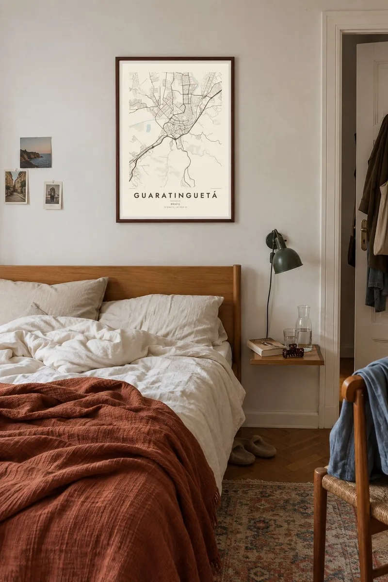

The map
Guaratinguetá lies in the Paraíba Valley between São Paulo and Rio de Janeiro. The Paraíba do Sul river winds past the city in wide loops, and on a map those curves are the most striking feature. The old centre sits on higher ground near the river, and newer neighbourhoods spread across the flat valley floor and up towards the surrounding hills.
The city is the birthplace of Frei Galvão, who in 2007 became the first Brazil-born saint, and religious sites linked to him draw visitors. It also neighbours Aparecida, the country's major pilgrimage town. Guaratinguetá is home to an air force school, and the federal highway linking São Paulo and Rio runs through the valley close by.
A Guaratinguetá map poster brings together river, road and old town in one frame. The meandering Paraíba gives the composition a soft, organic outline, and the historic centre adds a finer grid of streets. The long lines of the highway and railway running along the valley complete it, all rendered clearly in monochrome.
The river curves in broad loops along the city's edge, with oxbows and floodplain giving the map a flowing, natural border.
The older streets near the river form a compact, irregular grid around churches and squares, which stands out from the looser newer districts.
The highway and railway run parallel along the valley between São Paulo and Rio, cutting clean lines across the composition.
Make it yours
Add a date, a name or a line of your own, switch style, size or orientation.
The free preview is low-resolution with a watermark. Prints and HD files are rendered at 300 DPI, up to 7,200 × 10,800 px, without a watermark.
Why Guaratinguetá
For devotees of Frei Galvão, for families from the Vale do Paraíba, or for anyone who has travelled the Rio–São Paulo corridor, this map carries real meaning. The river curves also make it a handsome piece in its own right.
Personalise the title, the subtitle and the coordinates line, for example with a baptism date or a family name. Then choose one of five styles: Classic black & white, Noir, Paper, Blueprint or Sand. Paper gives the river loops a gentle, archival look.
Order the Guaratinguetá poster| Print size | Resolution | Files |
|---|---|---|
| 30 × 40 cm11.8 × 15.7″ | 3,543 × 4,724 px | PNG · PDF |
| 29.7 × 42 cm (A3)11.7 × 16.5″ | 3,508 × 4,961 px | PNG · PDF |
| 42 × 59.4 cm (A2)16.5 × 23.4″ | 4,961 × 7,016 px | PNG · PDF |
| 45.7 × 61 cm18 × 24″ | 5,400 × 7,200 px | PNG · PDF |
| 50 × 70 cm19.7 × 27.6″ | 5,906 × 8,268 px | PNG · PDF |
| 61 × 91.4 cm24 × 36″ | 7,200 × 10,800 px | PNG · PDF |
For comparison, the free preview is 900 px wide, watermarked and meant for screens. The HD files have up to 8× the resolution in each direction and print cleanly at full poster size.
Pick a style at the top of the page, then choose Printed Poster — a size and, if you like, a frame — or Digital HD Files. Checkout takes one step, and your order page updates as soon as the payment goes through.
It is printed on premium 200 gsm matte paper in one of six sizes, from 30 × 40 cm to 24 × 36″. Printed posters start at $39, shipping included.
Yes. Choose a solid wood frame in black, white, natural oak or dark wood. It comes with shatterproof glazing and is ready to hang. Framed posters start at $99, shipping included.
Shipping is free to 60+ countries. Each poster is printed by the nearest of our print partners in 30+ countries and usually arrives in 3–7 business days. You can follow the status and tracking under My Orders. A few countries take 2–5 weeks, and where we don't ship yet, the site tells you before you pay.
Send us a photo within 14 days of delivery and we will reprint it for free or refund you.
Yes. In the editor on this page, change the title, the subtitle and the coordinates line to anything you like, and pick a style and size. Printed, framed and digital orders all use exactly your design.
For $9 you get 300 DPI PNG and print-ready PDF files in all six sizes, without a watermark, to print anywhere. Not sure yet? Download a free watermarked preview first.
Nearby
