Converging trade roads
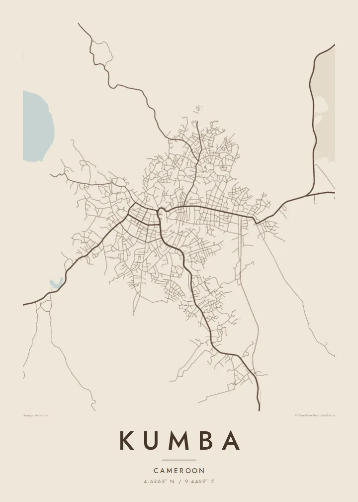
Several regional roads meet in the centre of Kumba. On the poster they form a clear hub, with the densest streets gathered where the town's markets and commerce have always been.
Minimalist map poster · Cameroon
A market town spread across green hills, with roads fanning out toward farmland and a round crater lake to the northwest
4.6363° N / 9.4469° E


One city, five moods
Tap a style to see it on the wall. Every style is included in the same $9 price.
 Actual pixels · 24 × 36″ HD file
Print-sharp
This is a crop of the real HD file at 100%. The paid download is rendered on our servers at 300 DPI, up to 7,200 × 10,800 pixels, so even the smallest lanes stay crisp on a 24 × 36″ print.
The map
Kumba is one of the larger towns in Cameroon's South-West Region, and on a map it reads as a loose, organic spread rather than a planned grid. Main roads come in from several directions and meet near the commercial centre. Between them, smaller streets follow the rise and fall of the ground, bending around slopes and stream beds instead of running in straight lines.
The town has long worked as a trading hub for the surrounding farm country, where cocoa and other cash crops are grown. That role shows in the street pattern. Routes converge on the market areas and then thin out into residential lanes, and the edges fade into plantations and forest with no sharp boundary. From above, the built-up area looks as though it grew outward along its roads.
A Kumba map poster shows this spreading, road-led shape in clean black lines on open paper. Just beyond the town lies Lake Barombi Mbo, a volcanic crater lake. Depending on the frame you choose, it can appear as a near-perfect circle at the edge of the composition, a quiet counterweight to the busy centre.
Several regional roads meet in the centre of Kumba. On the poster they form a clear hub, with the densest streets gathered where the town's markets and commerce have always been.
Northwest of town, Lake Barombi Mbo sits in an old volcanic crater. On a map it is an almost perfectly round body of water, surrounded by the steep, forested rim of the caldera.
Kumba has no ring road or hard city limit. Its streets taper off gradually into farmland, which gives the poster an open, feathered outline instead of a crisp border.
Make it yours
Add a date, a name or a line of your own, switch style, size or orientation.
Free preview is low-resolution with a watermark. The HD version is 7,200 × 10,800 px, 300 DPI, no watermark.
Why Kumba
For people from the South-West, Kumba is often the town where family, school or trade began. A map of its streets is a personal way to keep that place close, whether you live nearby or far away, without needing a photograph.
You can personalise the poster with your own title, a subtitle such as a family name or a year, and the coordinates line. Then pick one of five styles: Classic black & white, Noir, Paper, Blueprint or Sand.
Get the Kumba poster — $9| Print size | Resolution | Files |
|---|---|---|
| 30 × 40 cm | 3,543 × 4,724 px | PNG · PDF |
| 50 × 70 cm | 5,906 × 8,268 px | PNG · PDF |
| A3 · 29.7 × 42 cm | 3,508 × 4,961 px | PNG · PDF |
| A2 · 42 × 59.4 cm | 4,961 × 7,016 px | PNG · PDF |
| 18 × 24" | 5,400 × 7,200 px | PNG · PDF |
| 24 × 36" | 7,200 × 10,800 px | PNG · PDF |
For comparison, the free preview is 900 px wide, watermarked and meant for screens. The HD files have up to 8× the resolution in each direction and print cleanly at full poster size.
Yes. Drag and zoom the map in the editor — centre it on your neighbourhood, the old town or the whole metro area. The text updates independently.
The HD purchase includes 30×40 cm, 50×70 cm, A3, A2, 18×24″ and 24×36″, each as a 300 DPI PNG and a print-ready PDF.
You can download a free 900 px preview with a watermark. The paid HD files have no watermark and are sharp enough for large prints.
Send the PDF to any local print shop or online printing service and ask for the matching paper size. Matte paper and a thin black or oak frame suit this style best.
Nearby
