Poole Harbour
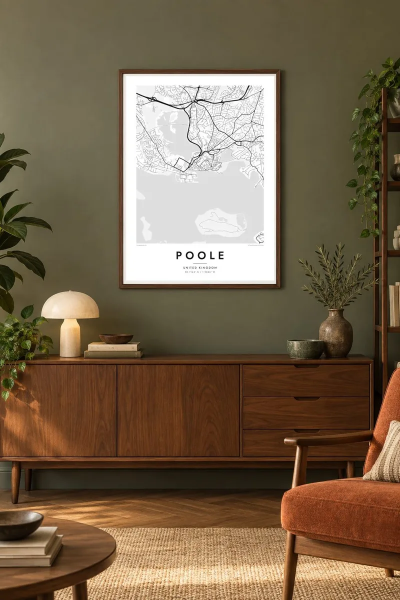
A vast shallow basin with a meandering shoreline of creeks and bays, dominating the western half of the map and giving the poster a large, calm field of open space.
Minimalist map poster · United Kingdom
50.7143° N / 1.9846° W
A town wrapped around one of the world's largest natural harbours, with wooded islands, a sand spit and a working quay.

One city, five moods
Tap a style to see it on the wall. Every style costs the same — printed, framed or as HD files.
 Actual pixels · 24 × 36″ print file
Print-sharp
This is a 100% crop of the real print file. Every poster — printed, framed or downloaded — is rendered on our servers at 300 DPI, up to 7,200 × 10,800 pixels, so even the smallest lanes stay crisp on a 24 × 36″ print.
On the wall


The map
From above, Poole is mostly water. The harbour spreads west of the town in a wide, shallow basin, its edges broken into creeks, inlets and marshy fingers of land. Brownsea Island sits in the middle like a dark leaf, with smaller islands scattered around it. The built-up area wraps the northern and eastern shores, then runs without a break into Bournemouth, so the streets read as one long coastal sweep.
The old town occupies a small peninsula between the harbour and Holes Bay, where the quay faces the water and narrow lanes run back from it. To the south, the Sandbanks spit reaches almost across the harbour mouth, leaving a narrow channel crossed by a chain ferry to Studland. On a map these features give the coastline an unusually intricate outline, with land and water interlocking at every scale.
A Poole map poster captures that interplay cleanly: the curved shoreline, the pale mass of the harbour, the close suburban streets climbing inland towards heath and parkland. Poole has long been a working port, with ferries to France and the Channel Islands leaving from its quays, and it is also known for its pottery. In black and white, the water becomes open space and the town becomes its frame.
A vast shallow basin with a meandering shoreline of creeks and bays, dominating the western half of the map and giving the poster a large, calm field of open space.
The largest island in the harbour sits as a solid wooded shape in the water. It is known for its red squirrels and as the site of the first Scout camp in 1907.
A thin spit of land curls towards the harbour mouth, lined with streets along both edges and ending at the short chain ferry crossing to the Studland shore.
Make it yours
Add a date, a name or a line of your own, switch style, size or orientation.
The free preview is low-resolution with a watermark. Prints and HD files are rendered at 300 DPI, up to 7,200 × 10,800 px, without a watermark.
Why Poole
People who have sailed, lived or holidayed around Poole often recognise the harbour outline before they read a single label. It is a map that works as a memory of a coastline, and it suits a hallway or a room with a view of the sea.
You can set your own title, subtitle and coordinates line, perhaps with a date that matters, and choose from Classic black & white, Noir, Paper, Blueprint or Sand. Blueprint and Sand both suit a harbour town, while Noir makes the water read as deep shadow.
Order the Poole poster| Print size | Resolution | Files |
|---|---|---|
| 30 × 40 cm11.8 × 15.7″ | 3,543 × 4,724 px | PNG · PDF |
| 29.7 × 42 cm (A3)11.7 × 16.5″ | 3,508 × 4,961 px | PNG · PDF |
| 42 × 59.4 cm (A2)16.5 × 23.4″ | 4,961 × 7,016 px | PNG · PDF |
| 45.7 × 61 cm18 × 24″ | 5,400 × 7,200 px | PNG · PDF |
| 50 × 70 cm19.7 × 27.6″ | 5,906 × 8,268 px | PNG · PDF |
| 61 × 91.4 cm24 × 36″ | 7,200 × 10,800 px | PNG · PDF |
For comparison, the free preview is 900 px wide, watermarked and meant for screens. The HD files have up to 8× the resolution in each direction and print cleanly at full poster size.
Pick a style at the top of the page, then choose Printed Poster — a size and, if you like, a frame — or Digital HD Files. Checkout takes one step, and your order page updates as soon as the payment goes through.
It is printed on premium 200 gsm matte paper in one of six sizes, from 30 × 40 cm to 24 × 36″. Printed posters start at $39, shipping included.
Yes. Choose a solid wood frame in black, white, natural oak or dark wood. It comes with shatterproof glazing and is ready to hang. Framed posters start at $99, shipping included.
Shipping is free to 60+ countries. Each poster is printed by the nearest of our print partners in 30+ countries and usually arrives in 3–7 business days. You can follow the status and tracking under My Orders. A few countries take 2–5 weeks, and where we don't ship yet, the site tells you before you pay.
Send us a photo within 14 days of delivery and we will reprint it for free or refund you.
Yes. In the editor on this page, change the title, the subtitle and the coordinates line to anything you like, and pick a style and size. Printed, framed and digital orders all use exactly your design.
For $9 you get 300 DPI PNG and print-ready PDF files in all six sizes, without a watermark, to print anywhere. Not sure yet? Download a free watermarked preview first.
Nearby
