Plaza-centred grid
Around the main square the streets keep a broadly regular colonial layout, a compact core of blocks that anchors the drawing before the terrain takes over.
Minimalist map poster · Mexico
19.2361° N / 101.4580° W
A mountain town on the steep southern slope of Michoacán, where streets drop toward the hot lowlands below
One city, five moods
Tap a style to see it on the wall. Every style costs the same — printed, framed or as HD files.
 Actual pixels · 24 × 36″ print file
Print-sharp
This is a 100% crop of the real print file. Every poster — printed, framed or downloaded — is rendered on our servers at 300 DPI, up to 7,200 × 10,800 pixels, so even the smallest lanes stay crisp on a 24 × 36″ print.
On the wall


The map
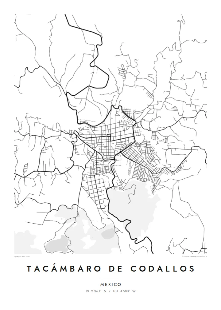
Tacámbaro de Codallos sits on the southern flank of Michoacán's volcanic highlands, where the mountains begin their descent toward the Tierra Caliente. The street plan is recognisably colonial around the main plaza, but the terrain bends it: streets tilt, blocks stretch and narrow, and the edges of town follow ravines and ridges rather than straight lines.
The surroundings are a landscape of pine forest and orchards, with avocado cultivation shaping much of the countryside. Just outside town lies La Alberca, a small, nearly circular crater lake that appears on the map as a neat round shape among the fields. Tacámbaro has been named a Pueblo Mágico, in recognition of its historic centre and setting.
The second half of its name honours Juan José Codallos, a figure of Mexico's independence era. A Tacámbaro de Codallos map poster brings together the orderly plaza, the sloping streets and the rounded crater lake nearby, a composition that feels both structured and organic, much like the town itself on its hillside.
Around the main square the streets keep a broadly regular colonial layout, a compact core of blocks that anchors the drawing before the terrain takes over.
A small volcanic crater lake near town forms an almost perfect circle on the map, one of the most distinctive shapes in the surrounding landscape.
The outer streets bend along ridges and ravines as the land falls southward, giving the edges of the plan an irregular, flowing outline.
Make it yours
Add a date, a name or a line of your own, switch style, size or orientation.
The free preview is low-resolution with a watermark. Prints and HD files are rendered at 300 DPI, up to 7,200 × 10,800 px, without a watermark.
Why Tacámbaro de Codallos
This map is chosen by people from Tacámbaro living elsewhere in Mexico or abroad, by visitors who stayed in the Pueblo Mágico, and by those who love towns shaped by mountains. It pairs a clear centre with a lively, irregular outline.
Personalise the title, subtitle and coordinates with a name, a date or a short dedication, and select Classic black & white, Noir, Paper, Blueprint or Sand. Order a printed poster with an optional wooden frame, or download the HD files for $9 and print locally.
Order the Tacámbaro de Codallos poster| Print size | Resolution | Files |
|---|---|---|
| 30 × 40 cm11.8 × 15.7″ | 3,543 × 4,724 px | PNG · PDF |
| 29.7 × 42 cm (A3)11.7 × 16.5″ | 3,508 × 4,961 px | PNG · PDF |
| 42 × 59.4 cm (A2)16.5 × 23.4″ | 4,961 × 7,016 px | PNG · PDF |
| 45.7 × 61 cm18 × 24″ | 5,400 × 7,200 px | PNG · PDF |
| 50 × 70 cm19.7 × 27.6″ | 5,906 × 8,268 px | PNG · PDF |
| 61 × 91.4 cm24 × 36″ | 7,200 × 10,800 px | PNG · PDF |
For comparison, the free preview is 900 px wide, watermarked and meant for screens. The HD files have up to 8× the resolution in each direction and print cleanly at full poster size.
Pick a style at the top of the page, then choose Printed Poster — a size and, if you like, a frame — or Digital HD Files. Checkout takes one step, and your order page updates as soon as the payment goes through.
It is printed on premium 200 gsm matte paper in one of six sizes, from 30 × 40 cm to 24 × 36″. Printed posters start at $39, shipping included.
Yes. Choose a solid wood frame in black, white, natural oak or dark wood. It comes with shatterproof glazing and is ready to hang. Framed posters start at $99, shipping included.
Shipping is free to 60+ countries. Each poster is printed by the nearest of our print partners in 30+ countries and usually arrives in 3–7 business days. You can follow the status and tracking under My Orders. A few countries take 2–5 weeks, and where we don't ship yet, the site tells you before you pay.
Send us a photo within 14 days of delivery and we will reprint it for free or refund you.
Yes. In the editor on this page, change the title, the subtitle and the coordinates line to anything you like, and pick a style and size. Printed, framed and digital orders all use exactly your design.
For $9 you get 300 DPI PNG and print-ready PDF files in all six sizes, without a watermark, to print anywhere. Not sure yet? Download a free watermarked preview first.
Nearby
