Paseo de la Reforma
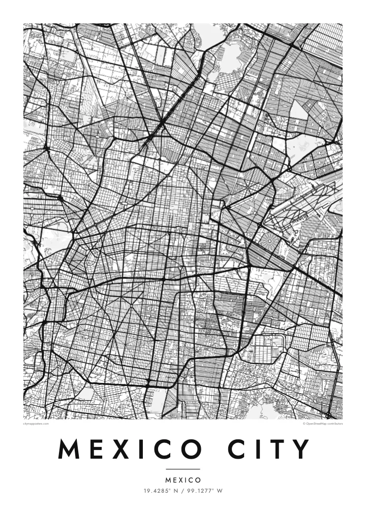
A broad avenue running diagonally from the edge of the centre to Chapultepec and beyond, punctuated by roundabouts and monuments, and one of the strongest lines on the map.
Ata mapa faigafua · Mexico
19.4285° N / 99.1277° W
A high valley city built on a drained lakebed, crossed by the long diagonal of Paseo de la Reforma


Kolo e tahi, lanu e nima
Tuki he sitaili ke sio ai ʻi te holo. ʻE tatau pē te totogi ʻo te sitaili fuli pē — mokā tā, fakakātoa, peʻe ko he ʻu faila HD.
 Ngaahi pikiseli moʻoni · faila tā 24 × 36″
Mahino lelei ki te pulūti
Ko he konga 100% ʻo te faila tā moʻoni ʻaeni. Ko te ʻu posita fuli pē — mokā tā, fakakātoa peʻe download — ʻe fakatupu ʻi ʻomātou seva ʻi te 300 DPI, aʻu ki te 7,200 × 10,800 pikiseli, koia ʻe nofo mahino ai te ʻu ala liliki ʻi he tā 24 × 36″.
ʻI Te Puipui


Te mapa
Mexico City sits in a high basin at about 2,240 metres, ringed by mountains and volcanoes. Much of it stands on the bed of Lake Texcoco, drained over the centuries after the Spanish conquest. The historic centre occupies the site of Tenochtitlan, the Aztec capital built on an island, and its grid of streets is still organised around the vast open square of the Zócalo.
West of the centre, Paseo de la Reforma cuts diagonally toward Chapultepec, a large wooded park with a hill, lakes and a castle. Nearby, neighbourhoods such as Roma and Condesa show curving streets and small plazas, while the Circuito Interior and the Periférico loop around the core. To the south, the canals of Xochimilco preserve a fragment of the old lake landscape.
Because it rests on soft lake clay, parts of the city have sunk by several metres over the past century. The historic centre and Xochimilco were inscribed together as a UNESCO World Heritage Site in 1987. A Mexico City map poster shows the old lake city beneath the modern grid, with Reforma, Chapultepec and the Zócalo as clear reference points.
A broad avenue running diagonally from the edge of the centre to Chapultepec and beyond, punctuated by roundabouts and monuments, and one of the strongest lines on the map.
One of the largest urban parks in the Americas, shown as a wide open area west of the centre with winding paths, lakes and the hill that gives it its name.
In the south, a network of narrow canals around chinampas, the traditional raised farm plots, recalls the lakes that once filled the whole valley.
Faʻu ke ʻau ʻa ʻau
Tuku he ʻaho, he hingoa peʻe he kiʻi palalau ʻa ʻau, fetogi te faʻahiga, te lahi peʻe te hake.
Ko te faʻata fua noa ʻe māʻulalo hono lelei pea ʻe ʻi ai he fakaʻilonga. Ko te ʻu tā mo te ʻu faila HD ʻe fakatupu ʻi te 300 DPI, aʻu ki te 7,200 × 10,800 px, ʻe mole ʻi ai he fakaʻilonga.
Koteā ko Mexico City
Mexico City means something different in every colonia, and a map poster lets you keep your own part of it close. It works for chilangos living abroad, for anyone who studied or worked there and for travellers who still think about it.
Write a colonia, a family name or a date in the title and subtitle, and edit the coordinates line to mark an address. Choose between Classic black & white, Noir, Paper, Blueprint and Sand, and get six print sizes as 300 DPI PNG and PDF files.
Fakatau te posita Mexico City| Lahi ʻo te pulūti | Mahino | Faile |
|---|---|---|
| 30 × 40 cm11.8 × 15.7″ | 3,543 × 4,724 px | PNG · PDF |
| 29.7 × 42 cm (A3)11.7 × 16.5″ | 3,508 × 4,961 px | PNG · PDF |
| 42 × 59.4 cm (A2)16.5 × 23.4″ | 4,961 × 7,016 px | PNG · PDF |
| 45.7 × 61 cm18 × 24″ | 5,400 × 7,200 px | PNG · PDF |
| 50 × 70 cm19.7 × 27.6″ | 5,906 × 8,268 px | PNG · PDF |
| 61 × 91.4 cm24 × 36″ | 7,200 × 10,800 px | PNG · PDF |
Ko te ata ʻe mole totogi ʻe 900 px tona laulahi, mo te fakaʻilonga, ki te sioʻata pē. Ko te ʻu faile HD ʻe aʻu ki te liuga 8 tona mahino, pea ʻe pulūti lelei ʻi te lahi kātoa.
Fili he sitaili ʻi te tuʻa ʻo te pasina, pea fili leva te Posita Tā — he lahi pea, kapau ʻe ke loto ai, he fakakātoa — peʻe ko te ʻu Faila HD Fakakomipiuta. ʻE tahi pē te sitepu ʻo te totogi, pea ʻe fakafou fakavavevave pē tau pasina fakatau mai te taimi ʻe fai ai te totogi.
ʻE tā ʻi he pepa lelei ʻaupito 200 gsm matte, ʻi he tahi ʻo te ono lahi, mai te 30 × 40 cm ki te 24 × 36″. ʻE kamata te ʻu posita tā ʻi te $39, kātoa mo te ʻave.
ʻIo. Fili he fakakātoa ʻakau moʻoni ʻi te kili, hinahina, ʻakau natula peʻe ʻakau ʻuliʻuli. ʻE ʻi ai mo he sioga mālohi ʻe mole mafesi, pea kua teu ke tautau. ʻE kamata te ʻu posita fakakātoa ʻi te $99, kātoa mo te ʻave.
Ko te fakahoko e mole totogi ki te ʼu fenua e 60+. Ko te pōsita taki taha ʼe tā e te tahi ʼo ʼemau ʼu kaufakalogo tā ʼe ofi mai, ʼi te ʼu fenua e 30+, pea ʼe hoko mai ʼi te ʼu ʼaho gaue e 3–7. ʼE feala hau ke ke vakaʼi te tuʼunga mo te tracking ʼi Oku Fakamaʼu. ʼE ʼi ai te ʼu fenua ʼe 2–5 te ʼu vaiaho, pea ʼi te ʼu fenua ʼaē ʼe heʼeki tou fakahoko ki ai, ʼe fakahā e te saite ʼi muʼa ʼo tau totogi.
Fekau mai he ʻata ʻi loto ʻi te ʻaho e 14 talu mai te aʻu mai, pea mātou toe tā noa peʻe toe totogi atu.
ʻIo. ʻI te meʻa fakatonutonu ʻi te pasina ʻaeni, fetogi te kupu tāfito, te kupu lalo pea mo te laina koʻoliteti ki he meʻa fuli pē ʻe ke loto ai, pea fili he sitaili mo he lahi. Ko te ʻu fakatau tā, fakakātoa mo fakakomipiuta ʻe fakaʻaogaʻi katoa pē tou fakatātā.
Mo te $9 ʻe ke maʻu ai te ʻu faila PNG 300 DPI mo PDF kua teu ke tā, ʻi te ono lahi kātoa, ʻe mole ʻi ai he fakaʻilonga, ke ke tā ai ʻi soʻo he potu. Kei tā fakafiafia? Download muʻa he faʻata mokā mo he fakaʻilonga, ʻe fua noa.
