Lettered grid
Streets in the old centre are identified by letters and numbers. This orderly colonial plan fills the flat ground between the hill and the bay.
Minimalist map poster · Haiti
19.7594° N / 72.1981° W
A colonial grid pressed between a mountain ridge and a wide bay, Haiti's northern port and former capital of Saint-Domingue.

One city, five moods
Tap a style to see it on the wall. Every style costs the same — printed, framed or as HD files.
 Actual pixels · 24 × 36″ print file
Print-sharp
This is a 100% crop of the real print file. Every poster — printed, framed or downloaded — is rendered on our servers at 300 DPI, up to 7,200 × 10,800 pixels, so even the smallest lanes stay crisp on a 24 × 36″ print.
On the wall

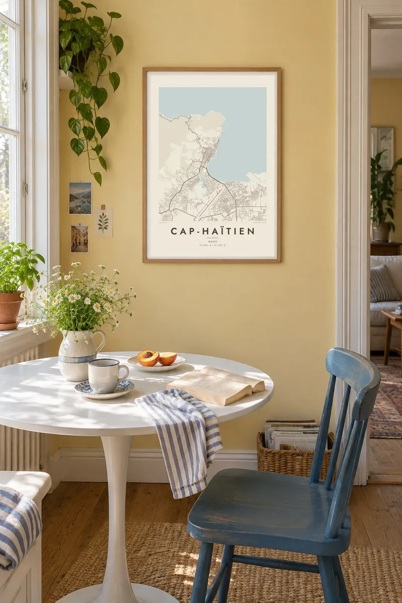

The map
Cap-Haïtien, known in colonial times as Cap-Français, lies on Haiti's north coast on a narrow strip of flat land between the steep slopes of the Morne du Cap and the bay. From above, its historic centre is one of the clearest grids in the Caribbean, with straight streets marked by letters and numbers running in regular blocks right up to the waterfront.
For much of the eighteenth century the city was the capital of the French colony of Saint-Domingue and one of the richest ports in the Americas. After independence it became the seat of Henri Christophe's northern kingdom. His Citadelle Laferrière and Sans-Souci Palace, in the mountains near Milot to the south, are inscribed together as a UNESCO World Heritage Site.
A Cap-Haïtien map poster lets the city plan speak for itself: the ordered streets, the harbour, the wall of hills and the curve of the coast leading west. In monochrome the grid looks almost architectural, and the Blueprint style makes the most of its precise, drafted quality.
Streets in the old centre are identified by letters and numbers. This orderly colonial plan fills the flat ground between the hill and the bay.
The steep ridge behind the city stops the grid abruptly. On the map, the dense blocks give way to winding tracks and open slopes.
The waterfront faces the bay directly. Its quays and the straight shoreline road form a clean edge against the open water.
Make it yours
Add a date, a name or a line of your own, switch style, size or orientation.
The free preview is low-resolution with a watermark. Prints and HD files are rendered at 300 DPI, up to 7,200 × 10,800 px, without a watermark.
Why Cap-Haïtien
Cap-Haïtien means a great deal to Haitians at home and in the diaspora, and to anyone who has climbed to the Citadelle. Its grid, sea and mountains make one of the most striking city plans in the region, easy to read at a glance.
You can set the title to Cap-Haïtien or Okap, add a subtitle and edit the coordinates line. Choose from five styles and check the free 900 px preview. Then download all six HD sizes for $9, or order a printed poster, framed or unframed.
Order the Cap-Haïtien poster| Print size | Resolution | Files |
|---|---|---|
| 30 × 40 cm11.8 × 15.7″ | 3,543 × 4,724 px | PNG · PDF |
| 29.7 × 42 cm (A3)11.7 × 16.5″ | 3,508 × 4,961 px | PNG · PDF |
| 42 × 59.4 cm (A2)16.5 × 23.4″ | 4,961 × 7,016 px | PNG · PDF |
| 45.7 × 61 cm18 × 24″ | 5,400 × 7,200 px | PNG · PDF |
| 50 × 70 cm19.7 × 27.6″ | 5,906 × 8,268 px | PNG · PDF |
| 61 × 91.4 cm24 × 36″ | 7,200 × 10,800 px | PNG · PDF |
For comparison, the free preview is 900 px wide, watermarked and meant for screens. The HD files have up to 8× the resolution in each direction and print cleanly at full poster size.
Pick a style at the top of the page, then choose Printed Poster — a size and, if you like, a frame — or Digital HD Files. Checkout takes one step, and your order page updates as soon as the payment goes through.
It is printed on premium 200 gsm matte paper in one of six sizes, from 30 × 40 cm to 24 × 36″. Printed posters start at $39, shipping included.
Yes. Choose a solid wood frame in black, white, natural oak or dark wood. It comes with shatterproof glazing and is ready to hang. Framed posters start at $99, shipping included.
Shipping is free to 60+ countries. Each poster is printed by the nearest of our print partners in 30+ countries and usually arrives in 3–7 business days. You can follow the status and tracking under My Orders. A few countries take 2–5 weeks, and where we don't ship yet, the site tells you before you pay.
Send us a photo within 14 days of delivery and we will reprint it for free or refund you.
Yes. In the editor on this page, change the title, the subtitle and the coordinates line to anything you like, and pick a style and size. Printed, framed and digital orders all use exactly your design.
For $9 you get 300 DPI PNG and print-ready PDF files in all six sizes, without a watermark, to print anywhere. Not sure yet? Download a free watermarked preview first.
Nearby
