Tortuga Channel
A narrow strait separates the island from Port-de-Paix on the Haitian mainland. On the map it is a clean band of water between two parallel coastlines.
Minimalist map poster · Haiti
20.0410° N / 72.7955° W
A long, humped island off Haiti's north coast, with steep cliffs on the north and a gentler side facing the mainland.

One city, five moods
Tap a style to see it on the wall. Every style costs the same — printed, framed or as HD files.
 Actual pixels · 24 × 36″ print file
Print-sharp
This is a 100% crop of the real print file. Every poster — printed, framed or downloaded — is rendered on our servers at 300 DPI, up to 7,200 × 10,800 pixels, so even the smallest lanes stay crisp on a 24 × 36″ print.
On the wall
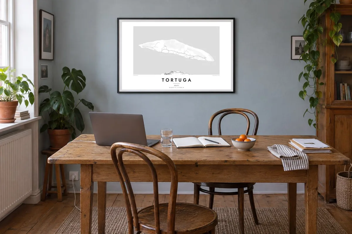


The island
Tortuga, Île de la Tortue in French, lies a few kilometres off the north coast of Haiti, across a narrow channel from Port-de-Paix. From above it is long and thin, running east to west, with a high central ridge. The north coast faces the Atlantic with steep cliffs. The southern shore looks toward the mainland, and that is where the villages and small harbours are.
There are few roads, mostly simple tracks linking settlements along the south coast and climbing into the hills. That restraint makes a Tortuga map poster graphic rather than busy. It shows a strong outline, the channel beside it, and the edge of the Haitian coast running along the lower part of the composition.
The island is named for its shape, which early Spanish sailors thought looked like a turtle's shell. In the seventeenth century Tortuga became one of the Caribbean's most notorious bases for buccaneers and pirates. French, English and Spanish interests fought over it, and it remains part of the popular picture of the age of piracy.
A narrow strait separates the island from Port-de-Paix on the Haitian mainland. On the map it is a clean band of water between two parallel coastlines.
The Atlantic side is steep and exposed, with few landing places and almost no settlement. Its unbroken edge contrasts with the gentler, inhabited coast facing south.
A line of hills runs the length of the island and gives it the humped profile that reminded sailors of a turtle's back. Its contours form the backbone of the print.
Make it yours
Add a date, a name or a line of your own, switch style, size or orientation.
The free preview is low-resolution with a watermark. Prints and HD files are rendered at 300 DPI, up to 7,200 × 10,800 px, without a watermark.
Why Tortuga
Tortuga appeals to Haitians and their families abroad, to readers of Caribbean history and to anyone raised on stories of buccaneers. Its outline is simple and memorable, easy to recognise from across a room, and it pairs well with other island or coastal prints.
Write your own title and subtitle, perhaps Île de la Tortue or a family name, and adjust the coordinates line. Choose Classic black & white, Noir, Paper, Blueprint or Sand. Then download the watermark-free HD files or order a printed poster.
Order the Tortuga poster| Print size | Resolution | Files |
|---|---|---|
| 30 × 40 cm11.8 × 15.7″ | 3,543 × 4,724 px | PNG · PDF |
| 29.7 × 42 cm (A3)11.7 × 16.5″ | 3,508 × 4,961 px | PNG · PDF |
| 42 × 59.4 cm (A2)16.5 × 23.4″ | 4,961 × 7,016 px | PNG · PDF |
| 45.7 × 61 cm18 × 24″ | 5,400 × 7,200 px | PNG · PDF |
| 50 × 70 cm19.7 × 27.6″ | 5,906 × 8,268 px | PNG · PDF |
| 61 × 91.4 cm24 × 36″ | 7,200 × 10,800 px | PNG · PDF |
For comparison, the free preview is 900 px wide, watermarked and meant for screens. The HD files have up to 8× the resolution in each direction and print cleanly at full poster size.
Pick a style at the top of the page, then choose Printed Poster — a size and, if you like, a frame — or Digital HD Files. Checkout takes one step, and your order page updates as soon as the payment goes through.
It is printed on premium 200 gsm matte paper in one of six sizes, from 30 × 40 cm to 24 × 36″. Printed posters start at $39, shipping included.
Yes. Choose a solid wood frame in black, white, natural oak or dark wood. It comes with shatterproof glazing and is ready to hang. Framed posters start at $99, shipping included.
Shipping is free to 60+ countries. Each poster is printed by the nearest of our print partners in 30+ countries and usually arrives in 3–7 business days. You can follow the status and tracking under My Orders. A few countries take 2–5 weeks, and where we don't ship yet, the site tells you before you pay.
Send us a photo within 14 days of delivery and we will reprint it for free or refund you.
Yes. In the editor on this page, change the title, the subtitle and the coordinates line to anything you like, and pick a style and size. Printed, framed and digital orders all use exactly your design.
For $9 you get 300 DPI PNG and print-ready PDF files in all six sizes, without a watermark, to print anywhere. Not sure yet? Download a free watermarked preview first.
Nearby
